How to get to Ze-Clean by bus?
Click on the bus route to see step by step directions with maps, line arrival times and updated time schedules.
From Telus Building, Edmonton
48 minFrom Walterdale Hill & Queen Elizabeth Park Road, Edmonton
39 minFrom Value Village, Edmonton
65 minFrom Butterdome Craft Sale, Edmonton
60 minFrom U of A Hospital-HMRC, Edmonton
51 minFrom La Cite Francophone, Edmonton
70 minFrom Comfort INN-Edmonton Downtown, Edmonton
44 minFrom William Hawrelak Park, Edmonton
62 minFrom Edmonton Folk Music Festival Site, Edmonton
55 minFrom USC - Grant MacEwan University Service Centre, Edmonton
51 min
Bus stops near Ze-Clean in Edmonton
Light Rail stations near Ze-Clean in Edmonton
- Dl Macdonald Platform, 32 min walk,VIEW
Bus lines to Ze-Clean in Edmonton
What are the closest stations to Ze-Clean?
The closest stations to Ze-Clean are:
- 87 Street & 144 Avenue is 362 meters away, 5 min walk.
- 89a Street & 150 Avenue is 477 meters away, 7 min walk.
- Dl Macdonald Platform is 2453 meters away, 32 min walk.
Which bus lines stop near Ze-Clean?
These bus lines stop near Ze-Clean: 009, 054, 113, 114.
What’s the nearest bus station to Ze-Clean in Edmonton?
The nearest bus station to Ze-Clean in Edmonton is 87 Street & 144 Avenue. It’s a 5 min walk away.
What time is the first bus to Ze-Clean in Edmonton?
The 113 is the first bus that goes to Ze-Clean in Edmonton. It stops nearby at 5:57 AM.
What time is the last bus to Ze-Clean in Edmonton?
The 114 is the last bus that goes to Ze-Clean in Edmonton. It stops nearby at 12:13 AM.
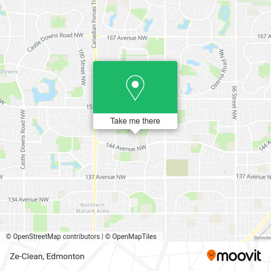
See Ze-Clean, Edmonton, on the map
Public Transit to Ze-Clean in Edmonton
Wondering how to get to Ze-Clean in Edmonton? Moovit helps you find the best way to get to Ze-Clean with step-by-step directions from the nearest public transit station.
Moovit provides free maps and live directions to help you navigate through your city. View schedules, routes, timetables, and find out how long does it take to get to Ze-Clean in real time.
Looking for the nearest stop or station to Ze-Clean? Check out this list of stops closest to your destination: 87 Street & 144 Avenue; 89a Street & 150 Avenue; Dl Macdonald Platform.
Bus: 009, 054, 113, 114, 610, 611.
Want to see if there’s another route that gets you there at an earlier time? Moovit helps you find alternative routes or times. Get directions from and directions to Ze-Clean easily from the Moovit App or Website.
We make riding to Ze-Clean easy, which is why over 1.5 million users, including users in Edmonton, trust Moovit as the best app for public transit. You don’t need to download an individual bus app or train app, Moovit is your all-in-one transit app that helps you find the best bus time or train time available.
For information on prices of bus and light rail, costs and ride fares to Ze-Clean, please check the Moovit app.
Use the app to navigate to popular places including to the airport, hospital, stadium, grocery store, mall, coffee shop, school, college, and university.
Ze-Clean Address: 147 Ave NW Edmonton, AB T5E 5Y6 street in Edmonton
- Sparkle Solutions,
- Keats Apartments,
- Haidar Painting,
- Ed's Barber Shop,
- Cardinal Leger Catholic Junior High School,
- Dante Alighieri Scuola di Lingua E Cultura Italiana di Edmonton,
- Cardinal Leger Junior High School,
- St. Olga Park,
- Comitato Promotore della Lingua Italiana,
- Veronco Electric 2024,
- Dickinsfield School,
- Dickinsfield Strip Mall,
- La Garderie Chrétienne Maison des Enfants,
- Aleppo Meats & Deli,
- Elite Beauty,
- Dickinsfield Child Development Center,
- North Central Public Health Centre,
- KC Coin Laundry LTD,
- Stitch N'Mend Alterations,
- Edmonton Decore Constituency Office
Places Near Ze-Clean (Edmonton)
- Whyte Avenue, Edmonton,
- Northgate Centre, Edmonton,
- Edmonton EXPO Centre, Edmonton,
- Rogers Place, Edmonton,
- Edmonton VIA Rail Station, Edmonton,
- Canada Place Service Canada Centre, Edmonton,
- Cross Cancer Institute, Edmonton,
- Londonderry Mall, Edmonton,
- Kaye Edmonton Clinic, Edmonton,
- West Edmonton Mall, Edmonton,
- Fort Edmonton Park, Edmonton,
- Kingsway Mall, Edmonton,
- Borden Park, Edmonton,
- Grey Nuns Community Hospital, Edmonton,
- Edmonton Commonwealth Stadium, Edmonton,
- University of Alberta, Edmonton,
- Edmonton Valley Zoo, Edmonton,
- Royal Alexandra Hospital, Edmonton,
- Alberta Legislature Building, Edmonton,
- MacEwan University, Edmonton
How to get to popular places in Edmonton with public transit
Get around Edmonton by public transit!
Traveling around Edmonton has never been so easy. See step by step directions as you travel to any attraction, street or major public transit station. View bus and train schedules, arrival times, service alerts and detailed routes on a map, so you know exactly how to get to anywhere in Edmonton.
When traveling to any destination around Edmonton use Moovit's Live Directions with Get Off Notifications to know exactly where and how far to walk, how long to wait for your line, and how many stops are left. Moovit will alert you when it's time to get off — no need to constantly re-check whether yours is the next stop.
Wondering how to use public transit in Edmonton or how to pay for public transit in Edmonton? Moovit public transit app can help you navigate your way with public transit easily, and at minimum cost. It includes public transit fees, ticket prices, and costs. Looking for a map of Edmonton public transit lines? Moovit public transit app shows all public transit maps in Edmonton with all Bus and Light Rail routes and stops on an interactive map.
Edmonton has 2 transit type(s), including: Bus and Light Rail, operated by several transit agencies, including ETS LRT, ETS, Strathcona County Transit, St. Albert Transit, Spruce Grove Transit, Fort Saskatchewan Transit, Beaumont Transit and Leduc Transit