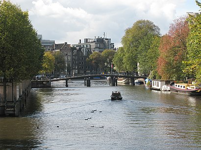
See Zwanenburgwal, Amsterdam, on the map
Directions to Zwanenburgwal (Amsterdam) with public transportation
The following transit lines have routes that pass near Zwanenburgwal
 Bus:
Bus: - Train:
- Metro:
How to get to Zwanenburgwal by bus?
Click on the bus route to see step by step directions with maps, line arrival times and updated time schedules.
How to get to Zwanenburgwal by train?
Click on the train route to see step by step directions with maps, line arrival times and updated time schedules.
How to get to Zwanenburgwal by metro?
Click on the metro route to see step by step directions with maps, line arrival times and updated time schedules.
Bus stations near Zwanenburgwal in Amsterdam
- Rembrandtplein,1 min walk,
- Amsterdam, Prins Hendrikkade,4 min walk,
- Muntplein,5 min walk,
- Waterlooplein,9 min walk,
Metro stations near Zwanenburgwal in Amsterdam
- Nieuwmarkt,3 min walk,
Bus lines to Zwanenburgwal in Amsterdam
- 4,Centraal Station,
- 14,Javaplein,
- N85,Gein,
- N87,Station Bijlmer Arena,
- N89,Zuiderzeeweg,
- N91,Nieuwendam,
- N93,Molenwijk,
- N06,Purmerend Overwhere,
- N07,Purmerend De Purmer,
- N11,Marken Via Monnickendam,
- N14,Edam,
- N19,Zaandam Via Landsmeer,
- N94,Assendelft Station,
- N82,Geuzenveld,
- N83,Osdorp De Aker,
- N88,Centraal Station,
- 246,Schiphol Airport/Plaza,
- N86,Station Bijlmer Arena,
What are the closest stations to Zwanenburgwal?
The closest stations to Zwanenburgwal are:
- Rembrandtplein is 53 meters away, 1 min walk.
- Nieuwmarkt is 204 meters away, 3 min walk.
- Amsterdam, Prins Hendrikkade is 232 meters away, 4 min walk.
- Muntplein is 316 meters away, 5 min walk.
- Waterlooplein is 640 meters away, 9 min walk.
Which bus lines stop near Zwanenburgwal?
These bus lines stop near Zwanenburgwal: 320, 347, 357, 37, 397, 800.
Which train lines stop near Zwanenburgwal?
These train lines stop near Zwanenburgwal: IC, ICD, SPR.
Which metro line stops near Zwanenburgwal?
54
What’s the nearest metro station to Zwanenburgwal in Amsterdam?
The nearest metro station to Zwanenburgwal in Amsterdam is Nieuwmarkt. It’s a 3 min walk away.
What’s the nearest bus stop to Zwanenburgwal in Amsterdam?
The nearest bus stop to Zwanenburgwal in Amsterdam is Rembrandtplein. It’s a 1 min walk away.
What time is the first light rail to Zwanenburgwal in Amsterdam?
The 4 is the first light rail that goes to Zwanenburgwal in Amsterdam. It stops nearby at 6:08 AM.
What time is the last light rail to Zwanenburgwal in Amsterdam?
The 4 is the last light rail that goes to Zwanenburgwal in Amsterdam. It stops nearby at 12:43 AM.
What time is the first metro to Zwanenburgwal in Amsterdam?
The 54 is the first metro that goes to Zwanenburgwal in Amsterdam. It stops nearby at 5:56 AM.
What time is the last metro to Zwanenburgwal in Amsterdam?
The 54 is the last metro that goes to Zwanenburgwal in Amsterdam. It stops nearby at 12:43 AM.
What time is the first bus to Zwanenburgwal in Amsterdam?
The N87 is the first bus that goes to Zwanenburgwal in Amsterdam. It stops nearby at 3:05 AM.
What time is the last bus to Zwanenburgwal in Amsterdam?
The N87 is the last bus that goes to Zwanenburgwal in Amsterdam. It stops nearby at 3:22 AM.
See Zwanenburgwal, Amsterdam, on the map
Public Transit to Zwanenburgwal in Amsterdam
Wondering how to get to Zwanenburgwal in Amsterdam, Netherlands? Moovit helps you find the best way to get to Zwanenburgwal with step-by-step directions from the nearest public transit station.
Moovit provides free maps and live directions to help you navigate through your city. View schedules, routes, timetables, and find out how long does it take to get to Zwanenburgwal in real time.
Looking for the nearest stop or station to Zwanenburgwal? Check out this list of stops closest to your destination: Rembrandtplein; Nieuwmarkt; Amsterdam, Prins Hendrikkade; Muntplein; Waterlooplein.
Bus:Train:Metro:
Want to see if there’s another route that gets you there at an earlier time? Moovit helps you find alternative routes or times. Get directions from and directions to Zwanenburgwal easily from the Moovit App or Website.
We make riding to Zwanenburgwal easy, which is why over 1.5 million users, including users in Amsterdam, trust Moovit as the best app for public transit. You don’t need to download an individual bus app or train app, Moovit is your all-in-one transit app that helps you find the best bus time or train time available.
For information on prices of bus, train and metro, costs and ride fares to Zwanenburgwal, please check the Moovit app.
Use the app to navigate to popular places including to the airport, hospital, stadium, grocery store, mall, coffee shop, school, college, and university.
Zwanenburgwal Address: Amsterdam street in Amsterdam
Attractions near Zwanenburgwal
Frenzi,Waterloopleinmarkt,Boekmanzaal,Amsterdam Light Festival,Amstel 1-Kamer 2245,Stadhuis,Stadsloket,Flohmarkt,Staalmeestersbrug,Muziektheater,Waterlooplein Market,Staalstraat,Boekenmarkt Oudemanhuispoort,Nationale Opera & Ballet,Nationale Opera En Ballet,MTN,Stayokay Hostel Amsterdam Stadsdoelen,Rembrandthuis,Rembrandt House,RembrandthuisHow to get to popular attractions in Amsterdam with public transit
Venlo, Venlo,IKEA, Utrecht,Station Geldermalsen, Geldermalsen,Station Veenendaal-De Klomp, Ede,Knooppunt Terbregseplein, Rotterdam,Westerpark, Amsterdam,ss Rotterdam, Rotterdam,Deventer, Deventer,Droomvlucht, Loon Op Zand,Scheveningen, 'S-Gravenhage,'s-Hertogenbosch, 'S-Hertogenbosch,Jeroen Bosch Ziekenhuis, 'S-Hertogenbosch,Scheveningse Pier, 'S-Gravenhage,Metrostation Kralingse Zoom, Rotterdam,Aegon, 'S-Gravenhage,Ministerie van Buitenlandse Zaken, 'S-Gravenhage,High Tech Campus, Eindhoven,Madurodam, 'S-Gravenhage,TESO-Veerboot Den Helder → Texel, Den Helder,Winkelcentrum In de Bogaard, RijswijkGet around Amsterdam by public transit!
Traveling around Amsterdam has never been so easy. See step by step directions as you travel to any attraction, street or major public transit station. View bus and train schedules, arrival times, service alerts and detailed routes on a map, so you know exactly how to get to anywhere in Amsterdam.
When traveling to any destination around Amsterdam use Moovit's Live Directions with Get Off Notifications to know exactly where and how far to walk, how long to wait for your line, and how many stops are left. Moovit will alert you when it's time to get off — no need to constantly re-check whether yours is the next stop.
Wondering how to use public transit in Amsterdam or how to pay for public transit in Amsterdam? Moovit public transit app can help you navigate your way with public transit easily, and at minimum cost. It includes public transit fees, ticket prices, and costs. Looking for a map of Amsterdam public transit lines? Moovit public transit app shows all public transit maps in Amsterdam with all bus, train or metro routes and stops on an interactive map.
Amsterdam has 3 transit type(s), including: bus, train or metro, operated by several transit agencies, including NS, NS International, GVB, GVB, GVB, GVB, U-OV, U-OV, Overal, HTM, R-net, RET, RET, De Lijn and Connexxion