Directions to kip bay towers (Manhattan) with public transportation
The following transit lines have routes that pass near kip bay towers
How to get to kip bay towers by bus?
Click on the bus route to see step by step directions with maps, line arrival times and updated time schedules.
How to get to kip bay towers by train?
Click on the train route to see step by step directions with maps, line arrival times and updated time schedules.
How to get to kip bay towers by subway?
Click on the subway route to see step by step directions with maps, line arrival times and updated time schedules.
Bus stations near kip bay towers in Manhattan
- 2 Av/E 32 St,1 min walk,
- 2 Av/E 31 St,2 min walk,
- E 34 St/2 Av,2 min walk,
- E 29 St/2 Av,4 min walk,
- 3 Av/E 33 St,4 min walk,
Subway stations near kip bay towers in Manhattan
- 33 St,8 min walk,
- Grand Central-42 St,16 min walk,
Ferry stations near kip bay towers in Manhattan
- East 34. St,9 min walk,
- East 34th Street,9 min walk,
Bus lines to kip bay towers in Manhattan
- M15-SBS,Select Bus Service Houston St Via 2 Av,
- M15,Pike St -Via 2 Av,
- BM5,Spring Creek Seaview Av Via Linden Bl Via Penn Av,
- M34-SBS,Select Bus East Side Fdr Dr Crosstown,
- M34A-SBS,Select Bus Pa Bus Trm Via 34 St Via 8 Av,
- M9,Battery Pk City Via Avenue C Via Pk Row,
- BXM1,Riverdale 263 St Via H Hudson Pkwy,
- M101,3 Av-96 St,
- M102,Harlem 147 St Via 3 Av Via Lenox Av,
- M103,East Harlem 125 St Via 3 Av,
What are the closest stations to kip bay towers?
The closest stations to kip bay towers are:
- 2 Av/E 32 St is 73 yards away, 1 min walk.
- 2 Av/E 31 St is 143 yards away, 2 min walk.
- E 34 St/2 Av is 159 yards away, 2 min walk.
- E 29 St/2 Av is 282 yards away, 4 min walk.
- 3 Av/E 33 St is 288 yards away, 4 min walk.
- 33 St is 610 yards away, 8 min walk.
- East 34. St is 735 yards away, 9 min walk.
- East 34th Street is 735 yards away, 9 min walk.
- Grand Central-42 St is 1334 yards away, 16 min walk.
Which bus lines stop near kip bay towers?
These bus lines stop near kip bay towers: BM2, BXM4, M15-SBS, M34-SBS, M34A-SBS, QM10, QM12, QM15, QM20, X37, X63.
Which train lines stop near kip bay towers?
These train lines stop near kip bay towers: HUDSON, MONTAUK, PATH, PORT JEFFERSON, PORT WASHINGTON.
Which subway lines stop near kip bay towers?
These subway lines stop near kip bay towers: 6, 6X.
What’s the nearest subway station to kip bay towers in Manhattan?
The nearest subway station to kip bay towers in Manhattan is 33 St. It’s a 8 min walk away.
What’s the nearest bus stop to kip bay towers in Manhattan?
The nearest bus stop to kip bay towers in Manhattan is 2 Av/E 32 St. It’s a 1 min walk away.
What’s the nearest ferry station to kip bay towers in Manhattan?
The nearest ferry stations to kip bay towers in Manhattan are East 34. St and East 34th Street. The closest one is a 9 min walk away.
What time is the first ferry to kip bay towers in Manhattan?
The SV is the first ferry that goes to kip bay towers in Manhattan. It stops nearby at 5:47 AM.
What time is the last ferry to kip bay towers in Manhattan?
The ER is the last ferry that goes to kip bay towers in Manhattan. It stops nearby at 10:12 PM.
What time is the first subway to kip bay towers in Manhattan?
The 6 is the first subway that goes to kip bay towers in Manhattan. It stops nearby at 3:03 AM.
What time is the last subway to kip bay towers in Manhattan?
The 6 is the last subway that goes to kip bay towers in Manhattan. It stops nearby at 3:47 AM.
What time is the first bus to kip bay towers in Manhattan?
The M102 is the first bus that goes to kip bay towers in Manhattan. It stops nearby at 3:17 AM.
What time is the last bus to kip bay towers in Manhattan?
The M103 is the last bus that goes to kip bay towers in Manhattan. It stops nearby at 2:59 AM.
How much is the train fare to kip bay towers?
The train fare to kip bay towers costs about $3.25 - $23.50.
How much is the bus fare to kip bay towers?
The bus fare to kip bay towers costs about $2.75.
How much is the subway fare to kip bay towers?
The subway fare to kip bay towers costs about $2.75.
See kip bay towers, Manhattan, on the map
Public Transit to kip bay towers in Manhattan
Wondering how to get to kip bay towers in Manhattan, United States? Moovit helps you find the best way to get to kip bay towers with step-by-step directions from the nearest public transit station.
Moovit provides free maps and live directions to help you navigate through your city. View schedules, routes, timetables, and find out how long does it take to get to kip bay towers in real time.
Looking for the nearest stop or station to kip bay towers? Check out this list of stops closest to your destination: 2 Av/E 32 St; 2 Av/E 31 St; E 34 St/2 Av; E 29 St/2 Av; 3 Av/E 33 St; 33 St; East 34. St; East 34th Street; Grand Central-42 St.
Bus:BM2BXM4M15-SBSM34-SBSM34A-SBSQM10QM12QM15QM20X37X63M15BM5Train:HUDSONMONTAUKPATHPORT JEFFERSONPORT WASHINGTONSubway:66X4S577XFerry:NEW YORK CITY & NEW JERSEY
Want to see if there’s another route that gets you there at an earlier time? Moovit helps you find alternative routes or times. Get directions from and directions to kip bay towers easily from the Moovit App or Website.
We make riding to kip bay towers easy, which is why over 1.5 million users, including users in Manhattan, trust Moovit as the best app for public transit. You don’t need to download an individual bus app or train app, Moovit is your all-in-one transit app that helps you find the best bus time or train time available.
For information on prices of bus, subway and train, costs and ride fares to kip bay towers, please check the Moovit app.
Use the app to navigate to popular places including to the airport, hospital, stadium, grocery store, mall, coffee shop, school, college, and university.
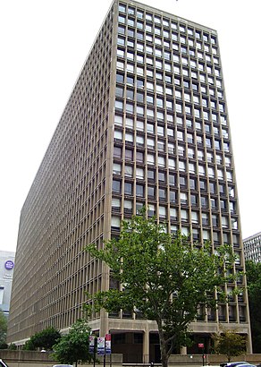
kip bay towers Address: 300 east 33rd 4m street in Manhattan
Attractions near kip bay towers
E 32nd St (32nd street & 2nd Ave),2nd Ave 32nd,JB Dance NYC,Midtown Animal Hospital,Amc Loews Kips Bay 15,2nd Ave,2nd Ave & E,33rd St at 2nd,Ninh's Vietnamese Sandwich & Bubble Tea,Albion,2nd 33rd St,The Fragrance Foundation,Nachtigall Margaret J,Manhattan Medical Associates,Amc Kips Bay 15,A&A Spa,New York College of Health Professions Academic Healthcare Clinic-Kips Bay,New York College Of Health Professionals,Kips Bat Towers Condominium (Kips Bay Towers Assoc),E 31st St 2nd AveHow to get to popular attractions in Manhattan with public transit
I-80 (Interstate 80), Paterson, Nj,The Dutch, Manhattan,Sheep Meadow, Manhattan,Jing Fong Restaurant 金豐大酒樓, Manhattan,The Meatball Shop,SoHo, Manhattan,Ulysses Folk House, Manhattan,Bubba Gump Shrimp Co., Manhattan,Newark Liberty International Airport (EWR), Newark, Nj,The 13th Step, Manhattan,Mission Dolores,Hill Country Chicken, Manhattan,Woorijip, Manhattan,The Park, Manhattan,Fette Sau,Central Park SummerStage, Manhattan,Roberta's Pizza,The Standard Grill, Manhattan,Jersey Shore University Medical Center, Neptune, Nj,Kew Gardens, NY, QueensGet around Manhattan by public transit!
Traveling around Manhattan has never been so easy. See step by step directions as you travel to any attraction, street or major public transit station. View bus and train schedules, arrival times, service alerts and detailed routes on a map, so you know exactly how to get to anywhere in Manhattan.
When traveling to any destination around Manhattan use Moovit's Live Directions with Get Off Notifications to know exactly where and how far to walk, how long to wait for your line, and how many stops are left. Moovit will alert you when it's time to get off — no need to constantly re-check whether yours is the next stop.
Wondering how to use public transit in Manhattan or how to pay for public transit in Manhattan? Moovit public transit app can help you navigate your way with public transit easily, and at minimum cost. It includes public transit fees, ticket prices, and costs. Looking for a map of Manhattan public transit lines? Moovit public transit app shows all public transit maps in Manhattan with all bus, subway or train routes and stops on an interactive map.
Manhattan has 3 transit type(s), including: bus, subway or train, operated by several transit agencies, including MTA Subway, Metro-North Railroad, LIRR, PATH, Shore Line East, MTA Bus Company, MTA New York City Transit - Express routes, MTA Bus, NJ Transit, NYC Ferry, NICE bus, Bee-Line Bus, NJ Transit Rail, NJ Transit Rail and Norwalk Transit District