
1 Bus Route Map
View the 1 route map and see all 1 stops along the route. The map of 1 shows where the bus travels and the location of each stop, making it easy to understand the entire route at a glance.
Explore Aachener Straßenbahn- und Energieversorgungs-AG routes on the map and see where Aachener Straßenbahn- und Energieversorgungs-AG bus services operate. Use the 1 map to find bus stops and see how the 1 connects different areas along its trip.
All 1 stops on the map are displayed in route order, helping you follow the 1 bus from the first stop to the last.
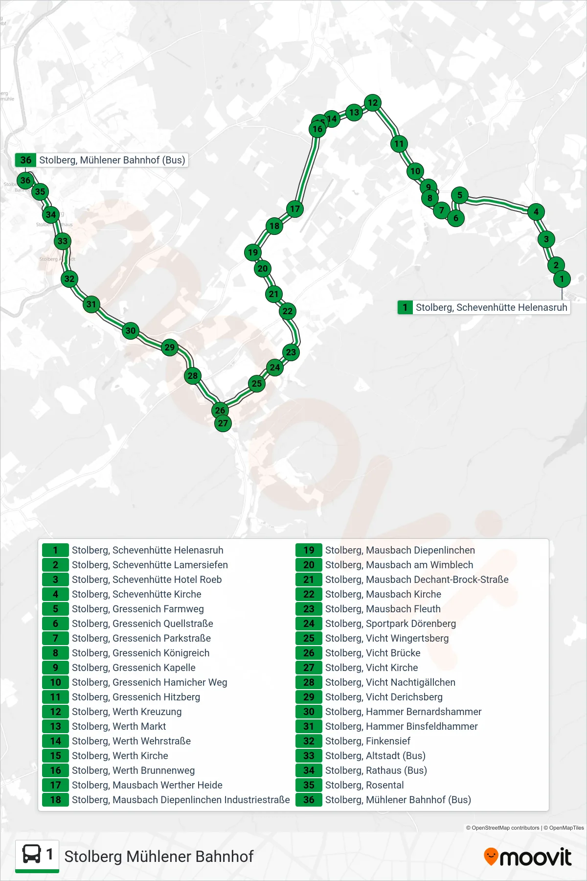
Stops list (1 - Stolberg Mühlener Bahnhof)
- Stolberg, Schevenhütte Helenasruh
- Stolberg, Schevenhütte Lamersiefen
- Stolberg, Schevenhütte Hotel Roeb
- Stolberg, Schevenhütte Kirche
- Stolberg, Gressenich Farmweg
- Stolberg, Gressenich Quellstraße
- Stolberg, Gressenich Parkstraße
- Stolberg, Gressenich Königreich
- Stolberg, Gressenich Kapelle
- Stolberg, Gressenich Hamicher Weg
- Stolberg, Gressenich Hitzberg
- Stolberg, Werth Kreuzung
- Stolberg, Werth Markt
- Stolberg, Werth Wehrstraße
- Stolberg, Werth Kirche
- Stolberg, Werth Brunnenweg
- Stolberg, Mausbach Werther Heide
- Stolberg, Mausbach Diepenlinchen Industriestraße
- Stolberg, Mausbach Diepenlinchen
- Stolberg, Mausbach am Wimblech
- Stolberg, Mausbach Dechant-Brock-Straße
- Stolberg, Mausbach Kirche
- Stolberg, Mausbach Fleuth
- Stolberg, Sportpark Dörenberg
- Stolberg, Vicht Wingertsberg
- Stolberg, Vicht Brücke
- Stolberg, Vicht Kirche
- Stolberg, Vicht Nachtigällchen
- Stolberg, Vicht Derichsberg
- Stolberg, Hammer Bernardshammer
- Stolberg, Hammer Binsfeldhammer
- Stolberg, Finkensief
- Stolberg, Altstadt (Bus)
- Stolberg, Rathaus (Bus)
- Stolberg, Rosental
- Stolberg, Mühlener Bahnhof (Bus)
Change direction
- Route Map - 1 - Aachen, Uniklinik
- Route Map - 1 - Aachen, Verlautenheide Quinx
- Route Map - 1 - Gressenich (Anschluss Nach Schevenhütte)
- Route Map - 1 - Aachen Bushof (Siegel)
- Route Map - 1 - Werth Kreuzung
- Route Map - 1 - Gressenich Kapelle
- Route Map - 1 - Stolberg, Altstadt (Bus)
- Route Map - 1 - Stolberg Altstadt
- Route Map - 1 - Aachen Bushof
- Route Map - 1 - Hält Nur Zum Aussteigen
- Route Map - 1 - Stolberg, Gressenich Farmweg
- Route Map - 1 - Vicht Brücke (Krewinkel - Gressenich)
- Route Map - 1 - Haaren Markt (Anschluss Nach Aachen)
- Route Map - 1 - Stolberg Mühlener Bahnhof
- Route Map - 1 - Schevenhütte Helenasruh
- Route Map - 1 - Stolberg, Gressenich Kapelle