
1 Bus Route Map
View the 1 route map and see all 1 stops along the route. The map of 1 shows where the bus travels and the location of each stop, making it easy to understand the entire route at a glance.
Explore Aachener Straßenbahn- und Energieversorgungs-AG routes on the map and see where Aachener Straßenbahn- und Energieversorgungs-AG bus services operate. Use the 1 map to find bus stops and see how the 1 connects different areas along its trip.
All 1 stops on the map are displayed in route order, helping you follow the 1 bus from the first stop to the last.
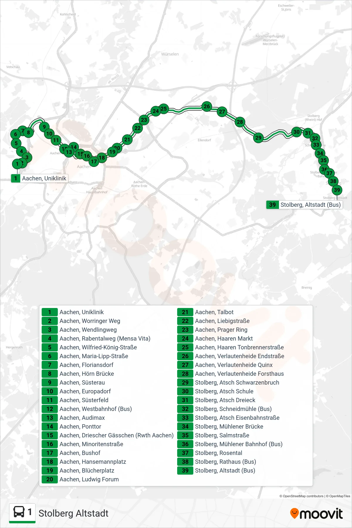
Stops list (1 - Stolberg Altstadt)
- Aachen, Uniklinik
- Aachen, Worringer Weg
- Aachen, Wendlingweg
- Aachen, Rabentalweg (Mensa Vita)
- Aachen, Wilfried-König-Straße
- Aachen, Maria-Lipp-Straße
- Aachen, Floriansdorf
- Aachen, Hörn Brücke
- Aachen, Süsterau
- Aachen, Europadorf
- Aachen, Süsterfeld
- Aachen, Westbahnhof (Bus)
- Aachen, Audimax
- Aachen, Ponttor
- Aachen, Driescher Gässchen (Rwth Aachen)
- Aachen, Minoritenstraße
- Aachen, Bushof
- Aachen, Hansemannplatz
- Aachen, Blücherplatz
- Aachen, Ludwig Forum
- Aachen, Talbot
- Aachen, Liebigstraße
- Aachen, Prager Ring
- Aachen, Haaren Markt
- Aachen, Haaren Tonbrennerstraße
- Aachen, Verlautenheide Endstraße
- Aachen, Verlautenheide Quinx
- Aachen, Verlautenheide Forsthaus
- Stolberg, Atsch Schwarzenbruch
- Stolberg, Atsch Schule
- Stolberg, Atsch Dreieck
- Stolberg, Schneidmühle (Bus)
- Stolberg, Atsch Eisenbahnstraße
- Stolberg, Mühlener Brücke
- Stolberg, Salmstraße
- Stolberg, Mühlener Bahnhof (Bus)
- Stolberg, Rosental
- Stolberg, Rathaus (Bus)
- Stolberg, Altstadt (Bus)
Change direction
- Route Map - 1 - Aachen, Uniklinik
- Route Map - 1 - Aachen, Verlautenheide Quinx
- Route Map - 1 - Gressenich (Anschluss Nach Schevenhütte)
- Route Map - 1 - Aachen Bushof (Siegel)
- Route Map - 1 - Werth Kreuzung
- Route Map - 1 - Gressenich Kapelle
- Route Map - 1 - Stolberg, Altstadt (Bus)
- Route Map - 1 - Aachen Bushof
- Route Map - 1 - Hält Nur Zum Aussteigen
- Route Map - 1 - Stolberg Mühlener Bahnhof
- Route Map - 1 - Stolberg, Gressenich Farmweg
- Route Map - 1 - Vicht Brücke (Krewinkel - Gressenich)
- Route Map - 1 - Haaren Markt (Anschluss Nach Aachen)
- Route Map - 1 - Stolberg Mühlener Bahnhof
- Route Map - 1 - Schevenhütte Helenasruh
- Route Map - 1 - Stolberg, Gressenich Kapelle