
1 Bus Route Map
View the 1 route map and see all 1 stops along the route. The map of 1 shows where the bus travels and the location of each stop, making it easy to understand the entire route at a glance.
Explore Stadtwerke Münster GmbH routes on the map and see where Stadtwerke Münster GmbH bus services operate. Use the 1 map to find bus stops and see how the 1 connects different areas along its trip.
All 1 stops on the map are displayed in route order, helping you follow the 1 bus from the first stop to the last.
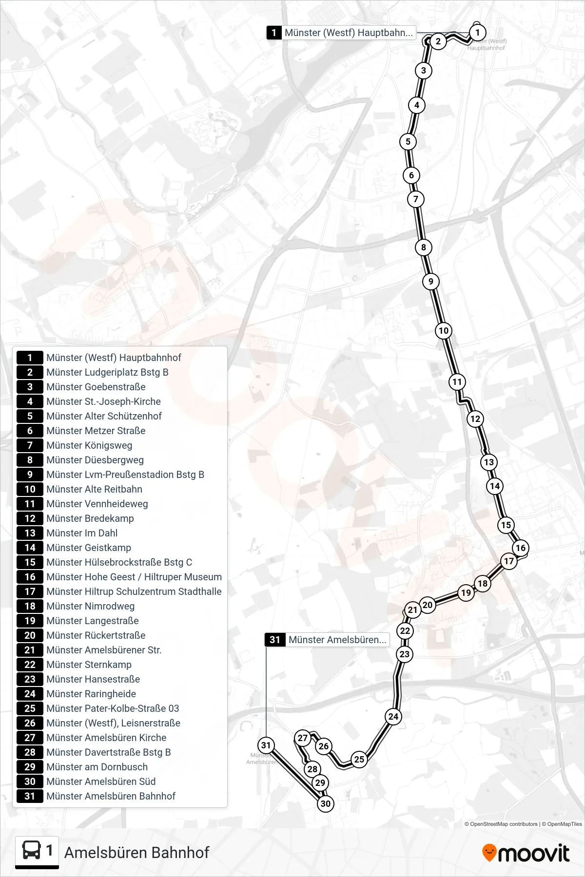
Stops list (1 - Amelsbüren Bahnhof)
- Münster (Westf) Hauptbahnhof
- Münster Ludgeriplatz Bstg B
- Münster Goebenstraße
- Münster St.-Joseph-Kirche
- Münster Alter Schützenhof
- Münster Metzer Straße
- Münster Königsweg
- Münster Düesbergweg
- Münster Lvm-Preußenstadion Bstg B
- Münster Alte Reitbahn
- Münster Vennheideweg
- Münster Bredekamp
- Münster Im Dahl
- Münster Geistkamp
- Münster Hülsebrockstraße Bstg C
- Münster Hohe Geest / Hiltruper Museum
- Münster Hiltrup Schulzentrum Stadthalle
- Münster Nimrodweg
- Münster Langestraße
- Münster Rückertstraße
- Münster Amelsbürener Str.
- Münster Sternkamp
- Münster Hansestraße
- Münster Raringheide
- Münster Pater-Kolbe-Straße 03
- Münster (Westf), Leisnerstraße
- Münster Amelsbüren Kirche
- Münster Davertstraße Bstg B
- Münster am Dornbusch
- Münster Amelsbüren Süd
- Münster Amelsbüren Bahnhof