
1 Bus Route Map
View the 1 route map and see all 1 stops along the route. The map of 1 shows where the bus travels and the location of each stop, making it easy to understand the entire route at a glance.
Explore Stadtwerke Münster GmbH routes on the map and see where Stadtwerke Münster GmbH bus services operate. Use the 1 map to find bus stops and see how the 1 connects different areas along its trip.
All 1 stops on the map are displayed in route order, helping you follow the 1 bus from the first stop to the last.
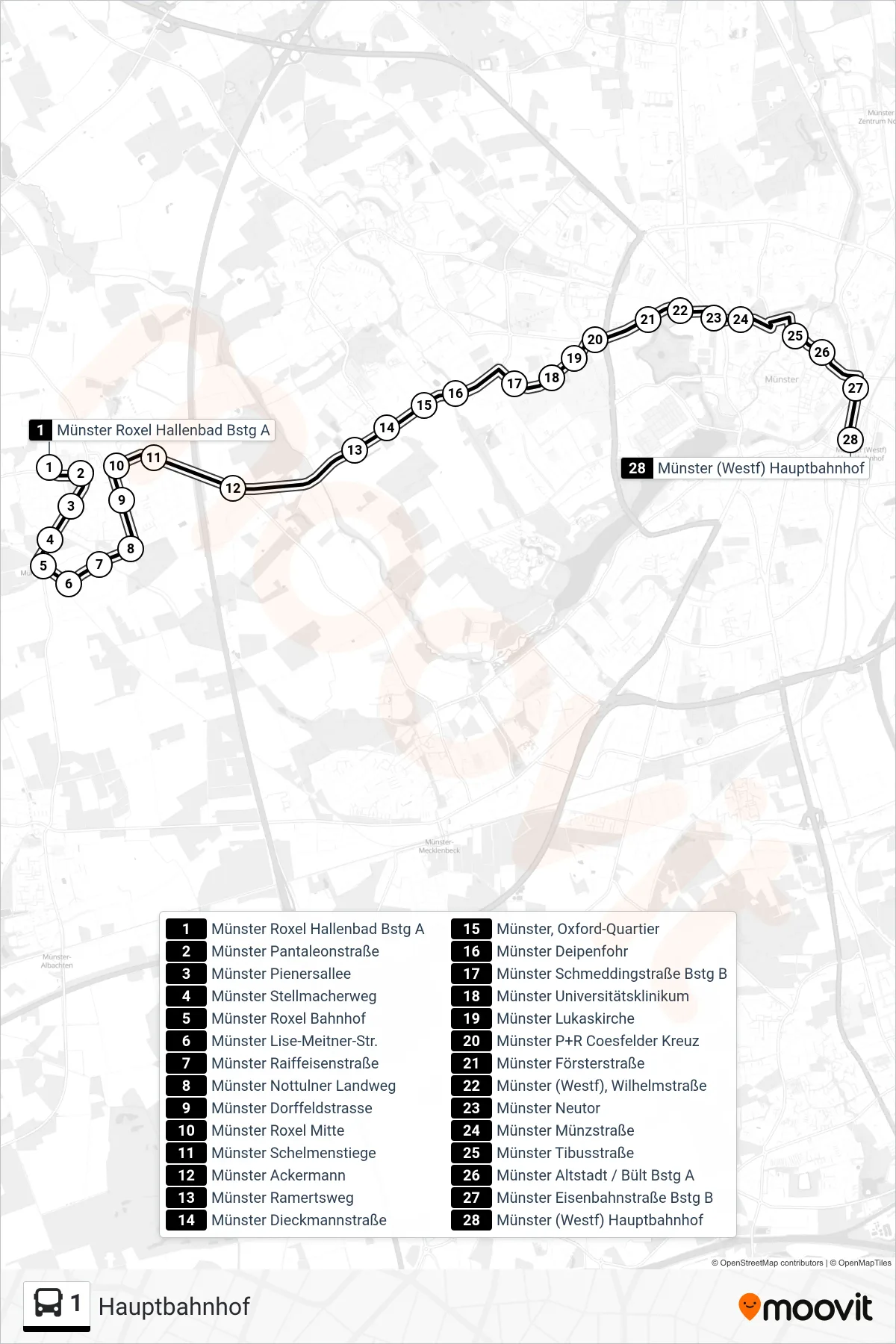
Stops list (1 - Hauptbahnhof)
- Münster Roxel Hallenbad Bstg A
- Münster Pantaleonstraße
- Münster Pienersallee
- Münster Stellmacherweg
- Münster Roxel Bahnhof
- Münster Lise-Meitner-Str.
- Münster Raiffeisenstraße
- Münster Nottulner Landweg
- Münster Dorffeldstrasse
- Münster Roxel Mitte
- Münster Schelmenstiege
- Münster Ackermann
- Münster Ramertsweg
- Münster Dieckmannstraße
- Münster, Oxford-Quartier
- Münster Deipenfohr
- Münster Schmeddingstraße Bstg B
- Münster Universitätsklinikum
- Münster Lukaskirche
- Münster P+R Coesfelder Kreuz
- Münster Försterstraße
- Münster (Westf), Wilhelmstraße
- Münster Neutor
- Münster Münzstraße
- Münster Tibusstraße
- Münster Altstadt / Bült Bstg A
- Münster Eisenbahnstraße Bstg B
- Münster (Westf) Hauptbahnhof