
10 Bus Route Map
View the 10 route map and see all 10 stops along the route. The map of 10 shows where the bus travels and the location of each stop, making it easy to understand the entire route at a glance.
Explore County Connection routes on the map and see where County Connection bus services operate. Use the 10 map to find bus stops and see how the 10 connects different areas along its trip.
All 10 stops on the map are displayed in route order, helping you follow the 10 bus from the first stop to the last.
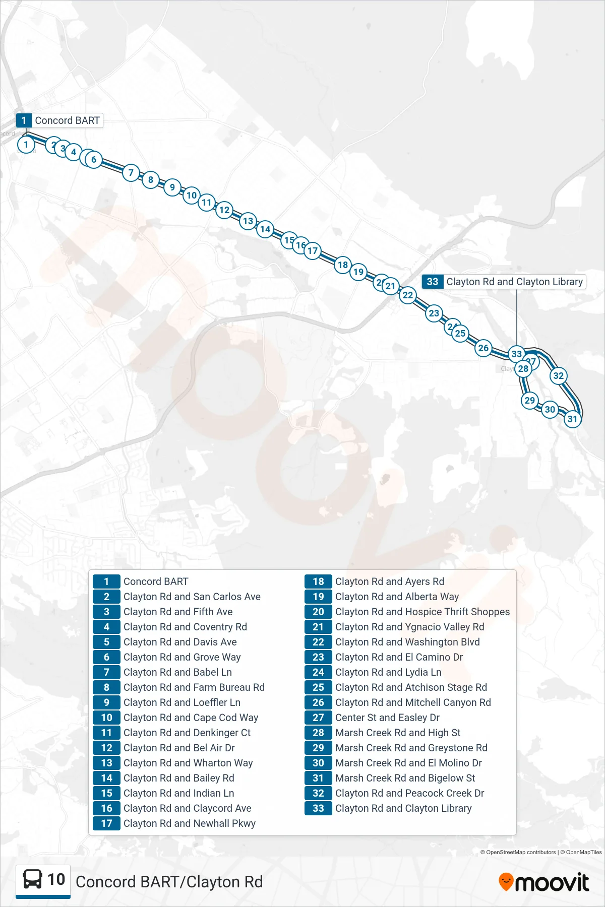
Stops list (10 - Clayton)
- Concord BART
- Clayton Rd and San Carlos Ave
- Clayton Rd and Fifth Ave
- Clayton Rd and Coventry Rd
- Clayton Rd and Davis Ave
- Clayton Rd and Grove Way
- Clayton Rd and Babel Ln
- Clayton Rd and Farm Bureau Rd
- Clayton Rd and Loeffler Ln
- Clayton Rd and Cape Cod Way
- Clayton Rd and Denkinger Ct
- Clayton Rd and Bel Air Dr
- Clayton Rd and Wharton Way
- Clayton Rd and Bailey Rd
- Clayton Rd and Indian Ln
- Clayton Rd and Claycord Ave
- Clayton Rd and Newhall Pkwy
- Clayton Rd and Ayers Rd
- Clayton Rd and Alberta Way
- Clayton Rd and Hospice Thrift Shoppes
- Clayton Rd and Ygnacio Valley Rd
- Clayton Rd and Washington Blvd
- Clayton Rd and El Camino Dr
- Clayton Rd and Lydia Ln
- Clayton Rd and Atchison Stage Rd
- Clayton Rd and Mitchell Canyon Rd
- Center St and Easley Dr
- Marsh Creek Rd and High St
- Marsh Creek Rd and Greystone Rd
- Marsh Creek Rd and El Molino Dr
- Marsh Creek Rd and Bigelow St
- Clayton Rd and Peacock Creek Dr
- Clayton Rd and Clayton Library