
100 Bus Route Map
View the 100 route map and see all 100 stops along the route. The map of 100 shows where the bus travels and the location of each stop, making it easy to understand the entire route at a glance.
Explore KSRTC Ordinary Bus Services routes on the map and see where KSRTC Ordinary Bus Services bus services operate. Use the 100 map to find bus stops and see how the 100 connects different areas along its trip.
All 100 stops on the map are displayed in route order, helping you follow the 100 bus from the first stop to the last.
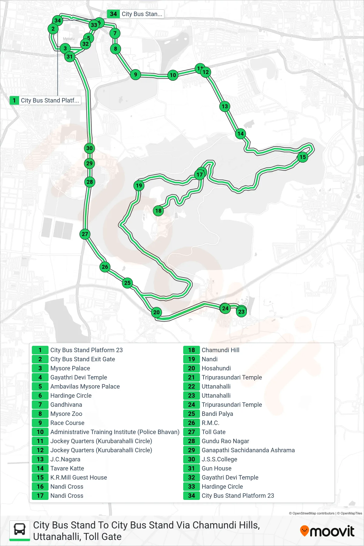
Stops list (100 - City Bus Stand To City Bus Stand Via Chamundi Hills, Uttanahalli, Toll Gate)
- City Bus Stand Platform 23
- City Bus Stand Exit Gate
- Mysore Palace
- Gayathri Devi Temple
- Ambavilas Mysore Palace
- Hardinge Circle
- Gandhivana
- Mysore Zoo
- Race Course
- Administrative Training Institute (Police Bhavan)
- Jockey Quarters (Kurubarahalli Circle)
- Jockey Quarters (Kurubarahalli Circle)
- J.C.Nagara
- Tavare Katte
- K.R.Mill Guest House
- Nandi Cross
- Nandi Cross
- Chamundi Hill
- Nandi
- Hosahundi
- Tripurasundari Temple
- Uttanahalli
- Uttanahalli
- Tripurasundari Temple
- Bandi Palya
- R.M.C.
- Toll Gate
- Gundu Rao Nagar
- Ganapathi Sachidananda Ashrama
- J.S.S.College
- Gun House
- Gayathri Devi Temple
- Hardinge Circle
- City Bus Stand Platform 23