
109 Bus Route Map
View the 109 route map and see all 109 stops along the route. The map of 109 shows where the bus travels and the location of each stop, making it easy to understand the entire route at a glance.
Explore Livorno and Province - Tuscan Bus Lines routes on the map and see where Livorno and Province - Tuscan Bus Lines bus services operate. Use the 109 map to find bus stops and see how the 109 connects different areas along its trip.
All 109 stops on the map are displayed in route order, helping you follow the 109 bus from the first stop to the last.
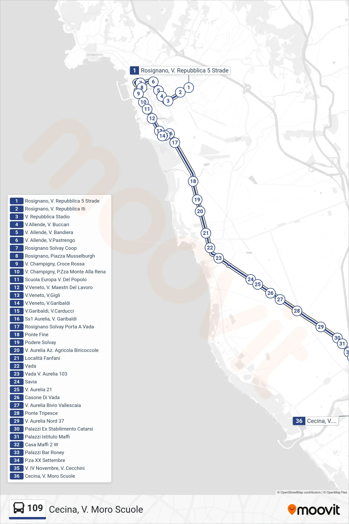
Stops list (109 - Cecina, Moro Schools)
- Rosignano, Repubblica St. 5 Roads
- Rosignano, Republic Street ITI
- Republic Street Stadium
- Allende St, Buccari St
- Allende Road, Bandiera Road
- Allende and Pastrengo Streets
- Rosignano Solvay Coop
- Rosignano, Musselburgh Square
- Champigny Street, Red Cross
- V. Champigny, Monte Alla Rena Square
- Europa School Via Del Popolo
- Veneto Street, Workers Masters Street
- Veneto St, Gigli St
- Veneto St., Garibaldi St.
- Via Garibaldi, Via Carducci
- SS1 Aurelia, Garibaldi Street
- Rosignano Solvay Porta A Vada
- Ponte Fine
- Solvay Estate
- Aurelia Road Biricoccole Farm
- Fanfani Area
- Vada
- Vada Aurelia Road 103
- Savia
- Aurelia Street 21
- Casone di Vada
- Via Aurelia Vallescaia Junction
- Tripesce Bridge
- North Aurelia Street 37
- Palazzi Former Catarsi Factory
- Maffi Institute Buildings
- Casa Maffi 2 West
- Palazzi Bar Roney
- XX September Square
- November 4th Street, Cecchini Street
- Cecina, Moro Schools