
11 Bus Route Map
View the 11 route map and see all 11 stops along the route. The map of 11 shows where the bus travels and the location of each stop, making it easy to understand the entire route at a glance.
Explore IZILO routes on the map and see where IZILO bus services operate. Use the 11 map to find bus stops and see how the 11 connects different areas along its trip.
All 11 stops on the map are displayed in route order, helping you follow the 11 bus from the first stop to the last.
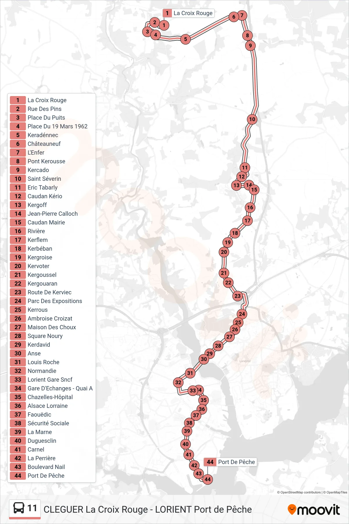
Stops list (11 - La Croix Rouge→Port De Pêche)
- La Croix Rouge
- Rue Des Pins
- Place Du Puits
- Place Du 19 Mars 1962
- Keradénnec
- Châteauneuf
- L'Enfer
- Pont Kerousse
- Kercado
- Saint Séverin
- Eric Tabarly
- Caudan Kério
- Kergoff
- Jean-Pierre Calloch
- Caudan Mairie
- Rivière
- Kerflem
- Kerbéban
- Kergroise
- Kervoter
- Kergoussel
- Kergouaran
- Route De Kerviec
- Parc Des Expositions
- Kerrous
- Ambroise Croizat
- Maison Des Choux
- Square Noury
- Kerdavid
- Anse
- Louis Roche
- Normandie
- Lorient Gare Sncf
- Gare D'Echanges - Quai A
- Chazelles-Hôpital
- Alsace Lorraine
- Faouëdic
- Sécurité Sociale
- La Marne
- Duguesclin
- Carnel
- La Perrière
- Boulevard Nail
- Port De Pêche