
132 Bus Route Map
View the 132 route map and see all 132 stops along the route. The map of 132 shows where the bus travels and the location of each stop, making it easy to understand the entire route at a glance.
Explore MARTA routes on the map and see where MARTA bus services operate. Use the 132 map to find bus stops and see how the 132 connects different areas along its trip.
All 132 stops on the map are displayed in route order, helping you follow the 132 bus from the first stop to the last.
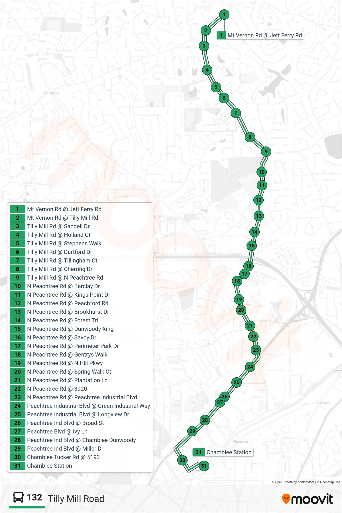
Stops list (132 - Chamblee Stn)
- Mt Vernon Rd @ Jett Ferry Rd
- Mt Vernon Rd @ Tilly Mill Rd
- Tilly Mill Rd @ Sandell Dr
- Tilly Mill Rd @ Holland Ct
- Tilly Mill Rd @ Stephens Walk
- Tilly Mill Rd @ Dartford Dr
- Tilly Mill Rd @ Tillingham Ct
- Tilly Mill Rd @ Cherring Dr
- Tilly Mill Rd @ N Peachtree Rd
- N Peachtree Rd @ Barclay Dr
- N Peachtree Rd @ Kings Point Dr
- N Peachtree Rd @ Peachford Rd
- N Peachtree Rd @ Brookhurst Dr
- N Peachtree Rd @ Forest Trl
- N Peachtree Rd @ Dunwoody Xing
- N Peachtree Rd @ Savoy Dr
- N Peachtree Rd @ Perimeter Park Dr
- N Peachtree Rd @ Gentrys Walk
- N Peachtree Rd @ N Hill Pkwy
- N Peachtree Rd @ Spring Walk Ct
- N Peachtree Rd @ Plantation Ln
- N Peachtree Rd @ 3920
- N Peachtree Rd @ Peachtree Industrial Blvd
- Peachtree Industrial Blvd @ Green Industrial Way
- Peachtree Industrial Blvd @ Longview Dr
- Peachtree Ind Blvd @ Broad St
- Peachtree Blvd @ Ivy Ln
- Peachtree Ind Blvd @ Chamblee Dunwoody
- Peachtree Ind Blvd @ Miller Dr
- Chamblee Tucker Rd @ 5193
- Chamblee Station