
14 Tram Route Map
View the 14 route map and see all 14 stops along the route. The map of 14 shows where the tram travels and the location of each stop, making it easy to understand the entire route at a glance.
Explore routes on the map and see where tram services operate. Use the 14 map to find tram stations and see how the 14 connects different areas along its trip.
All 14 stops on the map are displayed in route order, helping you follow the 14 tram from the first station to the last.
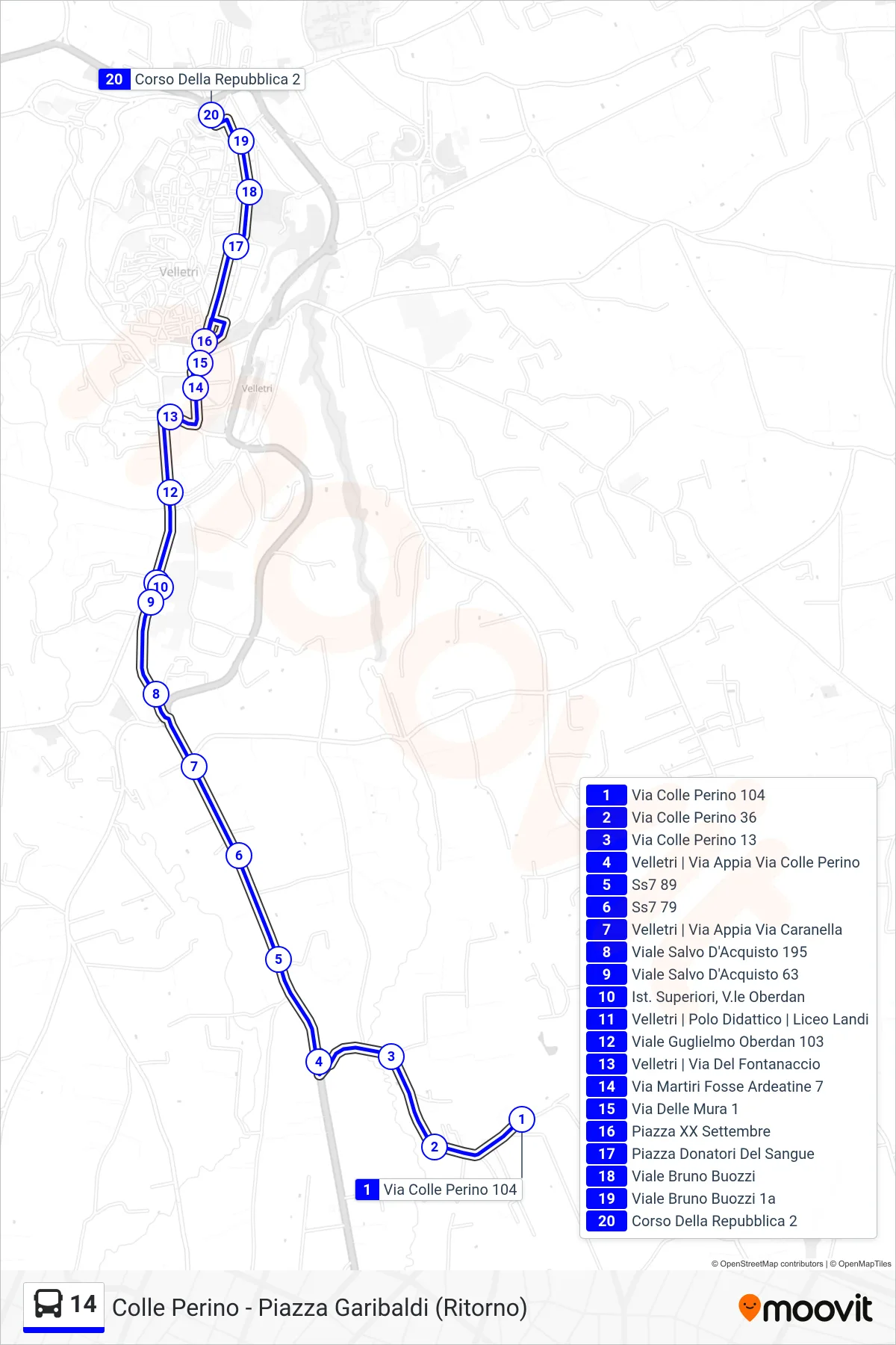
Stops list (14 - Colle Perino - Garibaldi Square (Return))
- Via Colle Perino 104
- 36 Colle Perino Street
- Colle Perino Street 13
- Velletri | Via Appia Via Colle Perino
- State Road 7 89
- State Road 7 79
- Velletri | Via Appia Via Caranella
- Salvo D'Acquisto Avenue 195
- Salvo D'Acquisto Avenue 63
- High Schools, Oberdan Avenue
- Velletri | Educational Center | Landi High School
- Guglielmo Oberdan Avenue 103
- Velletri | Fontanaccio Street
- 7 Ardeatine Martyrs Street
- Via Delle Mura 1
- XX Settembre Square
- Blood Donors Square
- Bruno Buozzi Avenue
- Bruno Buozzi Avenue 1a
- Republic Avenue 2