
14 Bus Route Map
View the 14 route map and see all 14 stops along the route. The map of 14 shows where the bus travels and the location of each stop, making it easy to understand the entire route at a glance.
Explore SMTD routes on the map and see where SMTD bus services operate. Use the 14 map to find bus stops and see how the 14 connects different areas along its trip.
All 14 stops on the map are displayed in route order, helping you follow the 14 bus from the first stop to the last.
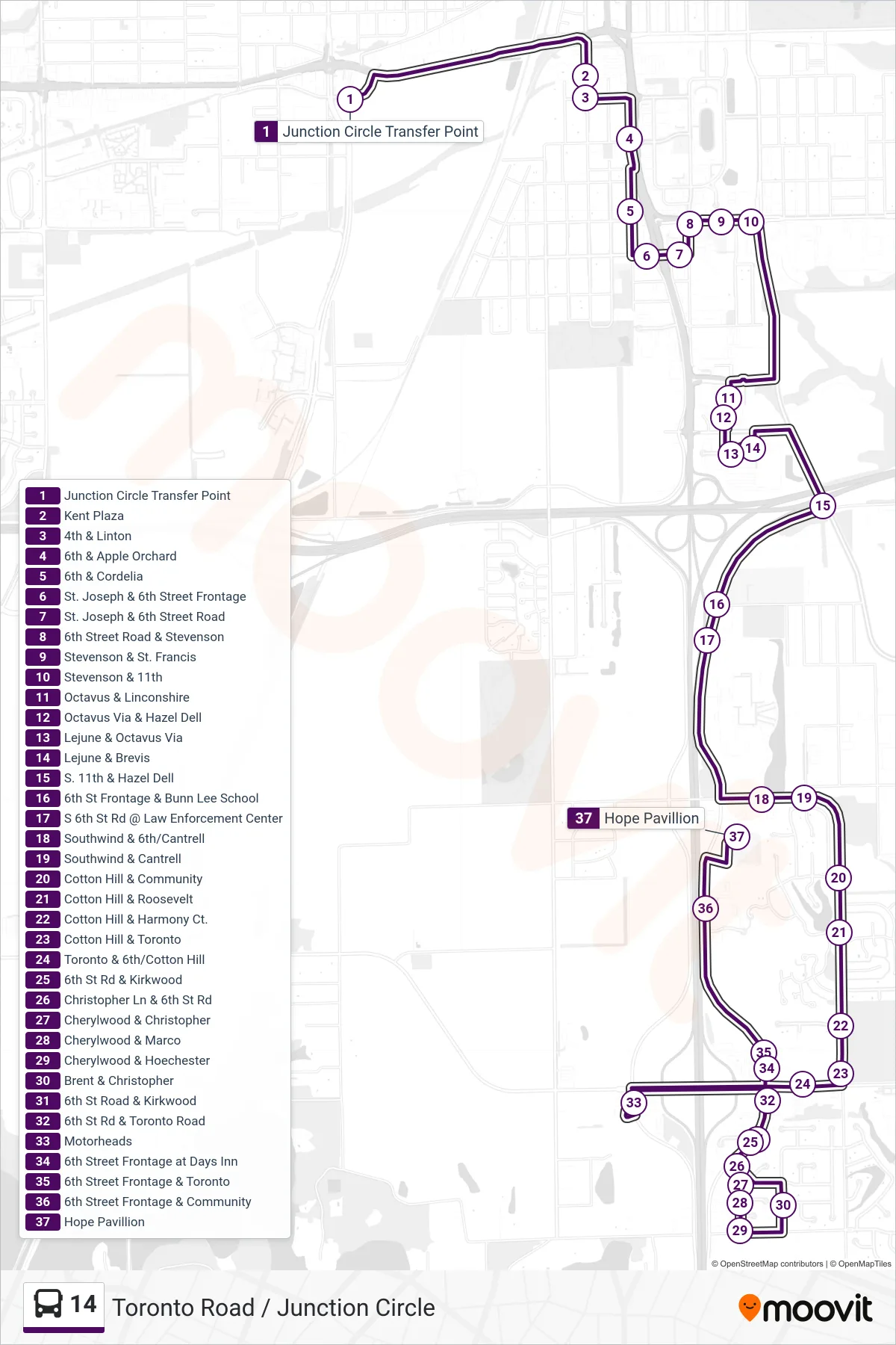
Stops list (14 - 14 Walmart Toronto Rd Hope Pavillion)
- Junction Circle Transfer Point
- Kent Plaza
- 4th & Linton
- 6th & Apple Orchard
- 6th & Cordelia
- St. Joseph & 6th Street Frontage
- St. Joseph & 6th Street Road
- 6th Street Road & Stevenson
- Stevenson & St. Francis
- Stevenson & 11th
- Octavus & Linconshire
- Octavus Via & Hazel Dell
- Lejune & Octavus Via
- Lejune & Brevis
- S. 11th & Hazel Dell
- 6th St Frontage & Bunn Lee School
- S 6th St Rd @ Law Enforcement Center
- Southwind & 6th/Cantrell
- Southwind & Cantrell
- Cotton Hill & Community
- Cotton Hill & Roosevelt
- Cotton Hill & Harmony Ct.
- Cotton Hill & Toronto
- Toronto & 6th/Cotton Hill
- 6th St Rd & Kirkwood
- Christopher Ln & 6th St Rd
- Cherylwood & Christopher
- Cherylwood & Marco
- Cherylwood & Hoechester
- Brent & Christopher
- 6th St Road & Kirkwood
- 6th St Rd & Toronto Road
- Motorheads
- 6th Street Frontage at Days Inn
- 6th Street Frontage & Toronto
- 6th Street Frontage & Community
- Hope Pavillion