
Recorrido de la línea 14 autobús
Consulta el mapa de la ruta de 14 y mira todas las paradas de 14 a lo largo del recorrido. El mapa de 14 muestra por dónde transita el autobús y la ubicación de cada parada, lo que facilita entender toda la ruta de un vistazo.
Explora las rutas de SMTD en el mapa y consulta por dónde operan los servicios de autobús de SMTD. Usa el mapa de 14 para encontrar las paradas de autobús y ver cómo la 14 conecta distintas zonas a lo largo de su recorrido.
Todas las paradas de 14 en el mapa se muestran en el orden de la ruta, lo que te ayuda a seguir el autobús de 14 desde la primera parada hasta la última.
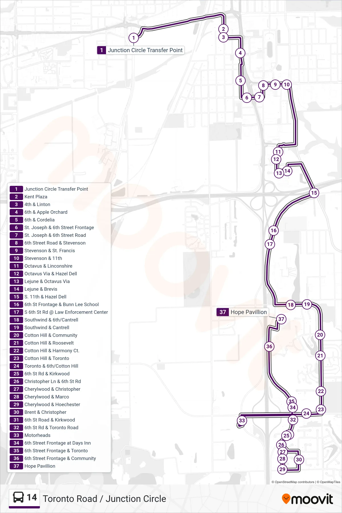
Lista de paradas (14 - 14 Walmart Toronto Rd Hope Pavillion)
- Junction Circle Transfer Point
- Kent Plaza
- 4th & Linton
- 6th & Apple Orchard
- 6th & Cordelia
- St. Joseph & 6th Street Frontage
- St. Joseph & 6th Street Road
- 6th Street Road & Stevenson
- Stevenson & St. Francis
- Stevenson & 11th
- Octavus & Linconshire
- Octavus Via & Hazel Dell
- Lejune & Octavus Via
- Lejune & Brevis
- S. 11th & Hazel Dell
- 6th St Frontage & Bunn Lee School
- S 6th St Rd @ Law Enforcement Center
- Southwind & 6th/Cantrell
- Southwind & Cantrell
- Cotton Hill & Community
- Cotton Hill & Roosevelt
- Cotton Hill & Harmony Ct.
- Cotton Hill & Toronto
- Toronto & 6th/Cotton Hill
- 6th St Rd & Kirkwood
- Christopher Ln & 6th St Rd
- Cherylwood & Christopher
- Cherylwood & Marco
- Cherylwood & Hoechester
- Brent & Christopher
- 6th St Road & Kirkwood
- 6th St Rd & Toronto Road
- Motorheads
- 6th Street Frontage at Days Inn
- 6th Street Frontage & Toronto
- 6th Street Frontage & Community
- Hope Pavillion