
16 Bus Route Map
View the 16 route map and see all 16 stops along the route. The map of 16 shows where the bus travels and the location of each stop, making it easy to understand the entire route at a glance.
Explore Transmac routes on the map and see where Transmac bus services operate. Use the 16 map to find bus stops and see how the 16 connects different areas along its trip.
All 16 stops on the map are displayed in route order, helping you follow the 16 bus from the first stop to the last.
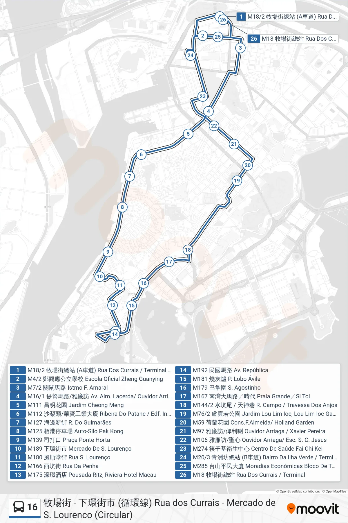
Stops list (16 - Rua dos Currais Terminal)
- M18/2 Currais Street Terminal (Lane A)
- Zheng Guanying Official School
- Barrier Gate Road
- Admiral Avenue / Ouvidor Arriaga
- Cheong Meng Garden
- Patane/Wa Pou Industrial Building
- M127 Guimaraes Road
- Pak Kong Parking Garage
- Praça Ponte Horta
- M189 São Lourenço Market
- St. Lawrence Street
- M166 Penha Street
- M175 Riviera Hotel Macau
- Republic Avenue
- M181 P. Lobo Avila
- M179 St. Augustine's
- M167 Praia Grande / Si Toi
- M144/2 Campo Street / Angels Lane
- M76/2 Lou Lim Ioc Garden
- M59 Holland Garden
- M97 Ouvidor Arriaga/Xavier Pereira
- Ouvidor Arriaga / Sacred Heart
- Fai Chi Kei Health Center
- Green Island District Terminal (Lane B)
- Tamagnini Barbosa Public Housing
- M18 Rua dos Currais Terminal