
16 Bus Route Map
View the 16 route map and see all 16 stops along the route. The map of 16 shows where the bus travels and the location of each stop, making it easy to understand the entire route at a glance.
Explore GoDurham routes on the map and see where GoDurham bus services operate. Use the 16 map to find bus stops and see how the 16 connects different areas along its trip.
All 16 stops on the map are displayed in route order, helping you follow the 16 bus from the first stop to the last.
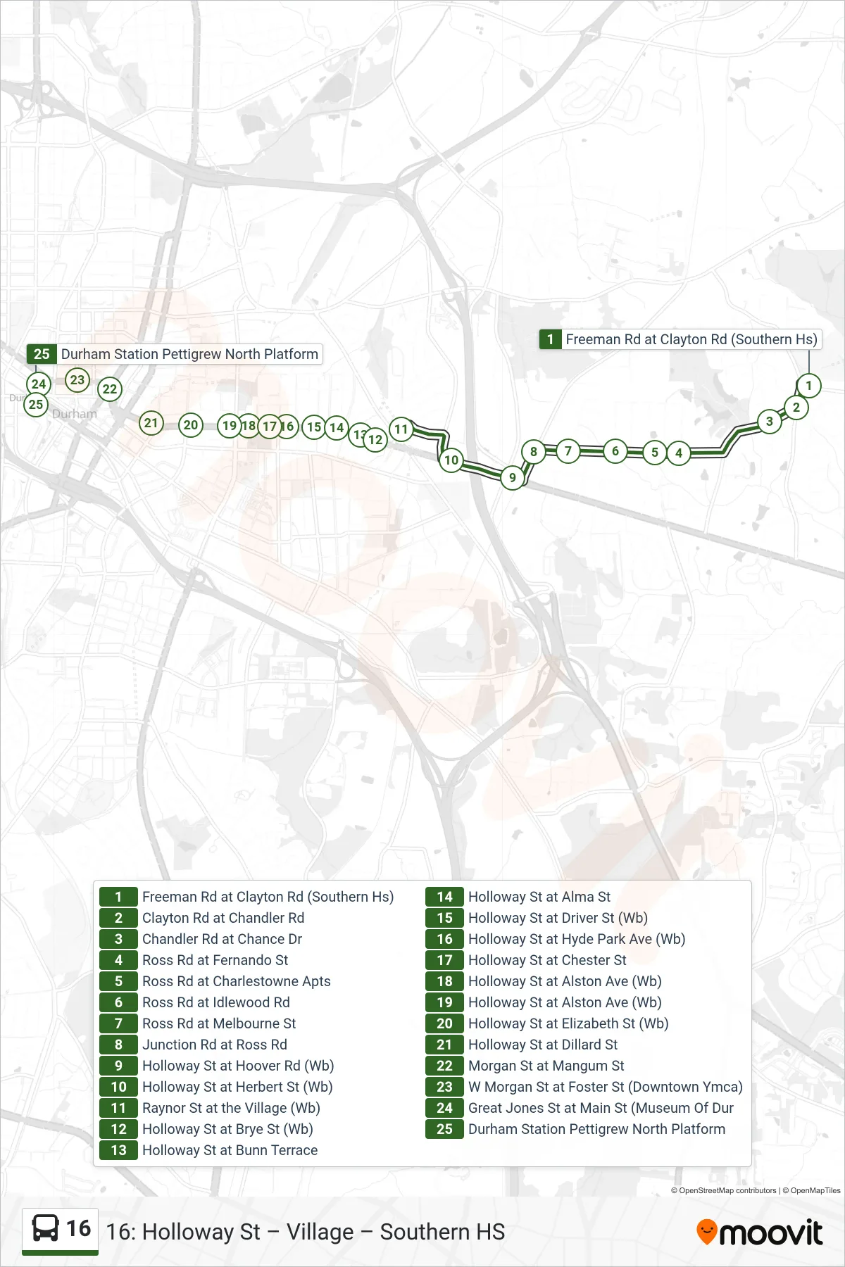
Stops list (16 - 16: Durham Station)
- Freeman Rd at Clayton Rd (Southern Hs)
- Clayton Rd at Chandler Rd
- Chandler Rd at Chance Dr
- Ross Rd at Fernando St
- Ross Rd at Charlestowne Apts
- Ross Rd at Idlewood Rd
- Ross Rd at Melbourne St
- Junction Rd at Ross Rd
- Holloway St at Hoover Rd (Wb)
- Holloway St at Herbert St (Wb)
- Raynor St at the Village (Wb)
- Holloway St at Brye St (Wb)
- Holloway St at Bunn Terrace
- Holloway St at Alma St
- Holloway St at Driver St (Wb)
- Holloway St at Hyde Park Ave (Wb)
- Holloway St at Chester St
- Holloway St at Alston Ave (Wb)
- Holloway St at Alston Ave (Wb)
- Holloway St at Elizabeth St (Wb)
- Holloway St at Dillard St
- Morgan St at Mangum St
- W Morgan St at Foster St (Downtown Ymca)
- Great Jones St at Main St (Museum Of Dur
- Durham Station Pettigrew North Platform