
16 Bus Route Map
View the 16 route map and see all 16 stops along the route. The map of 16 shows where the bus travels and the location of each stop, making it easy to understand the entire route at a glance.
Explore GoDurham routes on the map and see where GoDurham bus services operate. Use the 16 map to find bus stops and see how the 16 connects different areas along its trip.
All 16 stops on the map are displayed in route order, helping you follow the 16 bus from the first stop to the last.
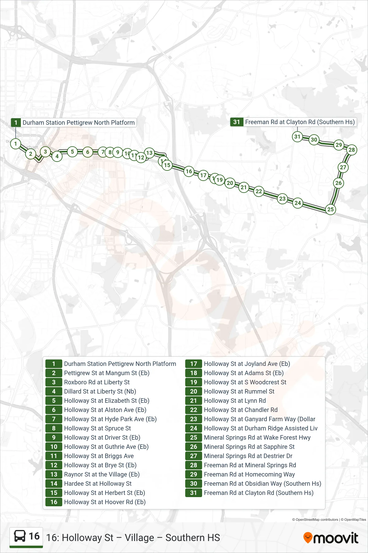
Stops list (16 - 16: Southern Hs)
- Durham Station Pettigrew North Platform
- Pettigrew St at Mangum St (Eb)
- Roxboro Rd at Liberty St
- Dillard St at Liberty St (Nb)
- Holloway St at Elizabeth St (Eb)
- Holloway St at Alston Ave (Eb)
- Holloway St at Hyde Park Ave (Eb)
- Holloway St at Spruce St
- Holloway St at Driver St (Eb)
- Holloway St at Guthrie Ave (Eb)
- Holloway St at Briggs Ave
- Holloway St at Brye St (Eb)
- Raynor St at the Village (Eb)
- Hardee St at Holloway St
- Holloway St at Herbert St (Eb)
- Holloway St at Hoover Rd (Eb)
- Holloway St at Joyland Ave (Eb)
- Holloway St at Adams St (Eb)
- Holloway St at S Woodcrest St
- Holloway St at Rummel St
- Holloway St at Lynn Rd
- Holloway St at Chandler Rd
- Holloway St at Ganyard Farm Way (Dollar
- Holloway St at Durham Ridge Assisted Liv
- Mineral Springs Rd at Wake Forest Hwy
- Mineral Springs Rd at Sapphire St
- Mineral Springs Rd at Destrier Dr
- Freeman Rd at Mineral Springs Rd
- Freeman Rd at Homecoming Way
- Freeman Rd at Obsidian Way (Southern Hs)
- Freeman Rd at Clayton Rd (Southern Hs)