
17 Bus Route Map
View the 17 route map and see all 17 stops along the route. The map of 17 shows where the bus travels and the location of each stop, making it easy to understand the entire route at a glance.
Explore GoRaleigh routes on the map and see where GoRaleigh bus services operate. Use the 17 map to find bus stops and see how the 17 connects different areas along its trip.
All 17 stops on the map are displayed in route order, helping you follow the 17 bus from the first stop to the last.
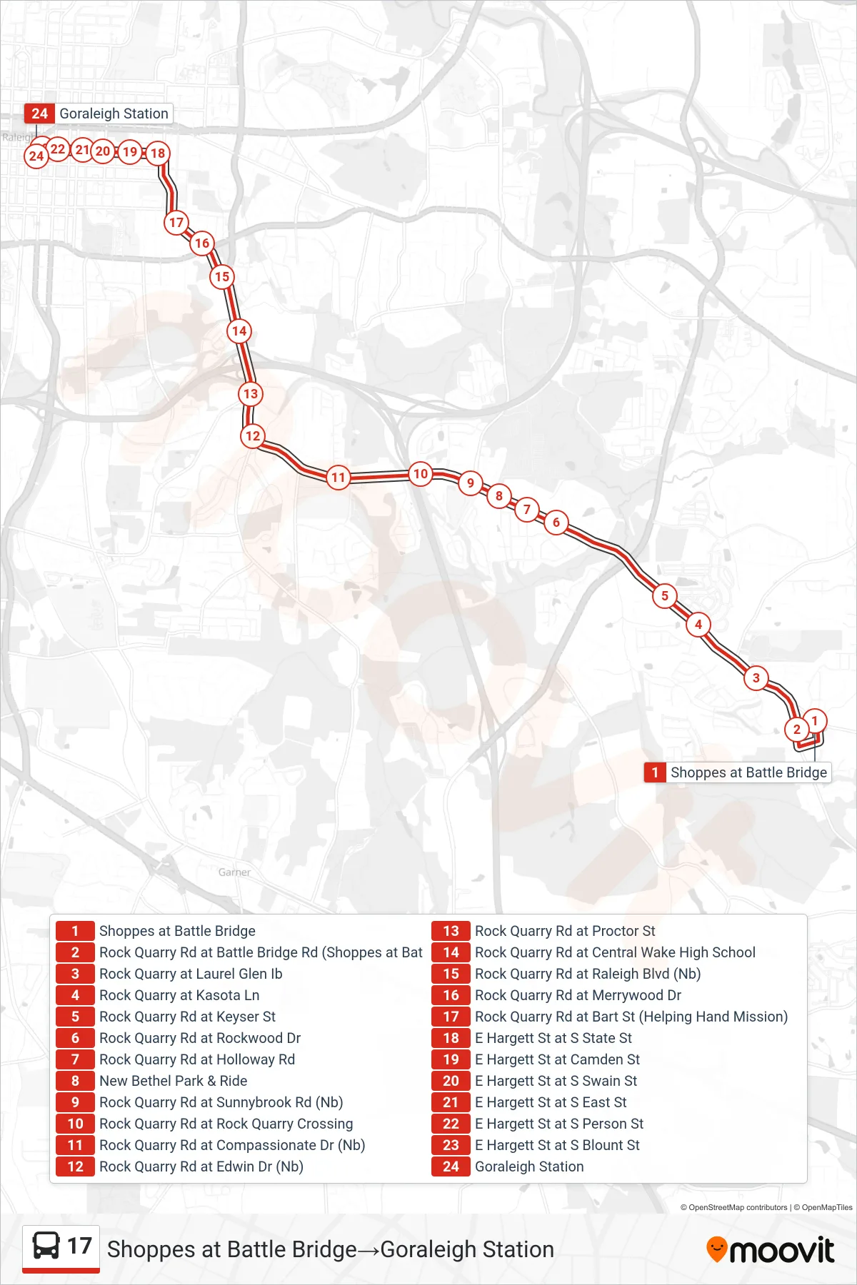
Stops list (17 - Shoppes at Battle Bridge→Goraleigh Station)
- Shoppes at Battle Bridge
- Rock Quarry Rd at Battle Bridge Rd (Shoppes at Bat
- Rock Quarry at Laurel Glen Ib
- Rock Quarry at Kasota Ln
- Rock Quarry Rd at Keyser St
- Rock Quarry Rd at Rockwood Dr
- Rock Quarry Rd at Holloway Rd
- New Bethel Park & Ride
- Rock Quarry Rd at Sunnybrook Rd (Nb)
- Rock Quarry Rd at Rock Quarry Crossing
- Rock Quarry Rd at Compassionate Dr (Nb)
- Rock Quarry Rd at Edwin Dr (Nb)
- Rock Quarry Rd at Proctor St
- Rock Quarry Rd at Central Wake High School
- Rock Quarry Rd at Raleigh Blvd (Nb)
- Rock Quarry Rd at Merrywood Dr
- Rock Quarry Rd at Bart St (Helping Hand Mission)
- E Hargett St at S State St
- E Hargett St at Camden St
- E Hargett St at S Swain St
- E Hargett St at S East St
- E Hargett St at S Person St
- E Hargett St at S Blount St
- Goraleigh Station