
17 Bus Route Map
View the 17 route map and see all 17 stops along the route. The map of 17 shows where the bus travels and the location of each stop, making it easy to understand the entire route at a glance.
Explore GoRaleigh routes on the map and see where GoRaleigh bus services operate. Use the 17 map to find bus stops and see how the 17 connects different areas along its trip.
All 17 stops on the map are displayed in route order, helping you follow the 17 bus from the first stop to the last.
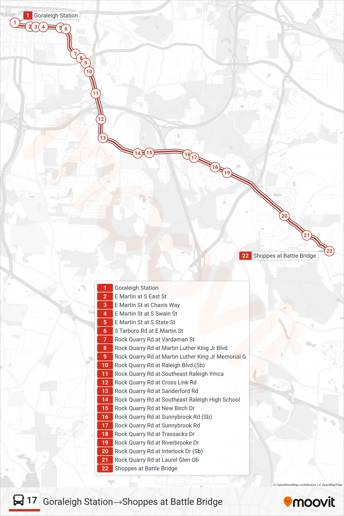
Stops list (17 - Goraleigh Station→Shoppes at Battle Bridge)
- Goraleigh Station
- E Martin at S East St
- E Martin St at Chavis Way
- E Martin St at S Swain St
- E Martin St at S State St
- S Tarboro Rd at E Martin St
- Rock Quarry Rd at Vardaman St
- Rock Quarry Rd at Martin Luther King Jr Blvd
- Rock Quarry Rd at Martin Luther King Jr Memorial G
- Rock Quarry Rd at Raleigh Blvd (Sb)
- Rock Quarry Rd at Southeast Raleigh Ymca
- Rock Quarry Rd at Cross Link Rd
- Rock Quarry Rd at Sanderford Rd
- Rock Quarry Rd at Southeast Raleigh High School
- Rock Quarry Rd at New Birch Dr
- Rock Quarry Rd at Sunnybrook Rd (Sb)
- Rock Quarry Rd at Sunnybrook Rd
- Rock Quarry Rd at Trassacks Dr
- Rock Quarry Rd at Riverbrooke Dr
- Rock Quarry Rd at Interlock Dr (Sb)
- Rock Quarry Rd at Laurel Glen Ob
- Shoppes at Battle Bridge