
19 Bus Route Map
View the 19 route map and see all 19 stops along the route. The map of 19 shows where the bus travels and the location of each stop, making it easy to understand the entire route at a glance.
Explore Nateev Express routes on the map and see where Nateev Express bus services operate. Use the 19 map to find bus stops and see how the 19 connects different areas along its trip.
All 19 stops on the map are displayed in route order, helping you follow the 19 bus from the first stop to the last.
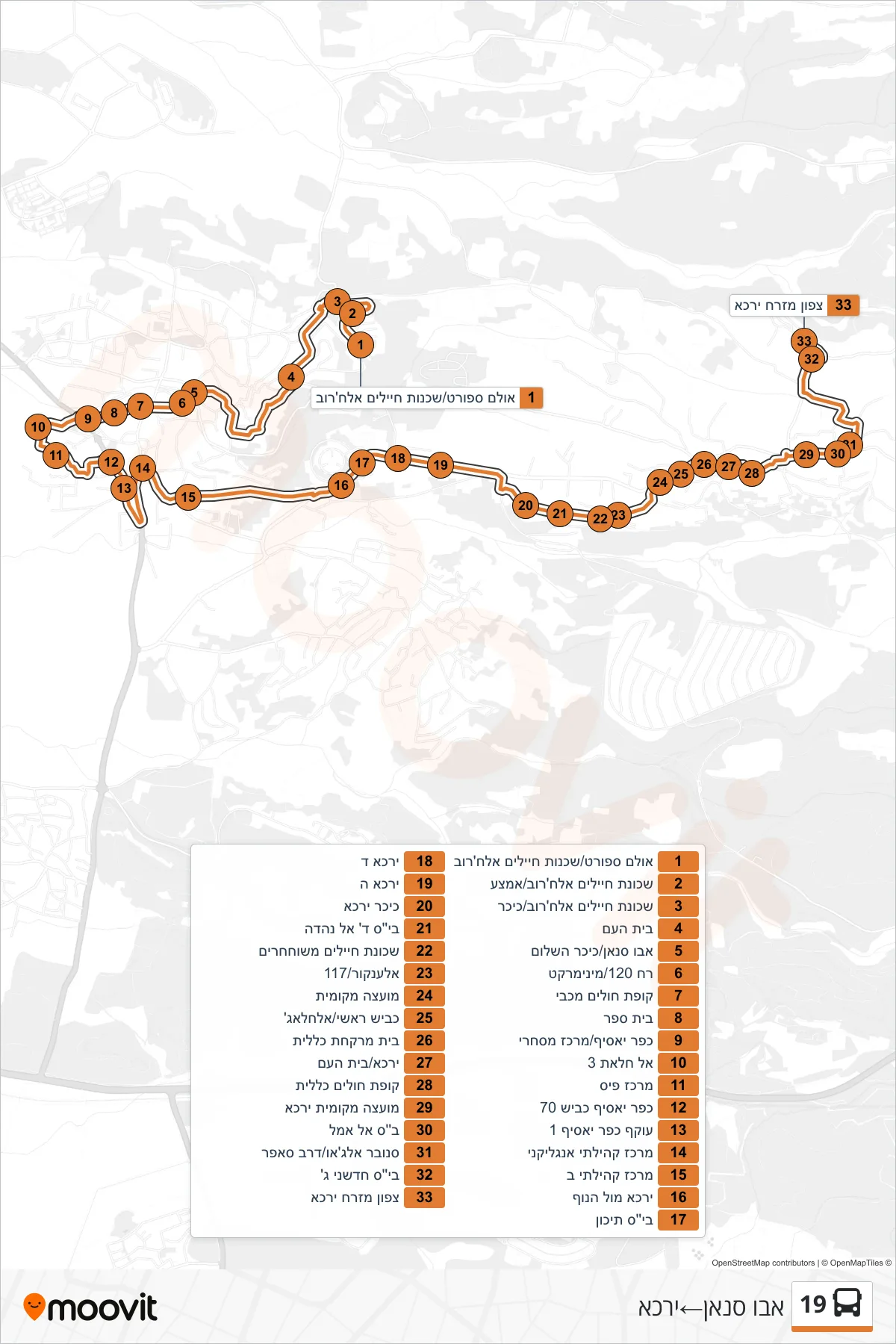
Stops list (19 - Abu Sinan→Yarka)
- Sports Hall/Soldiers Quarter Alkharub
- Soldiers Quarter Alkharub/Middle
- Soldiers Quarter Alkharub/Circle
- Beit Ha'am
- Abu Sinan/Peace Square
- Street 120/Mini Market
- Maccabi Health Center
- School
- Kafr Yasif/Commercial Center
- Al Halat 3
- Pais Center
- Kafr Yasif Road 70
- Kafr Yasif Bypass 1
- Anglican Community Center
- Community Center B
- Yarka Mul HaNof
- High School
- Yarka D
- Yarka E
- Yarka Square
- Al-Nahda School
- Released Soldiers Neighborhood
- Al-Ankur/117
- Local Council
- Main Road/Al-Hallaj
- Clalit Pharmacy
- Yarka/Beit HaAm
- Health Clinic
- Yarka Local Council
- Al Amal School
- Snober Aljao/Darb Safer
- New School G
- Northeast Yarka