
2 Light Rail Route Map
View the 2 route map and see all 2 stops along the route. The map of 2 shows where the light rail travels and the location of each stop, making it easy to understand the entire route at a glance.
Explore HTM routes on the map and see where HTM light rail services operate. Use the 2 map to find light rail stations and see how the 2 connects different areas along its trip.
All 2 stops on the map are displayed in route order, helping you follow the 2 light rail from the first station to the last.
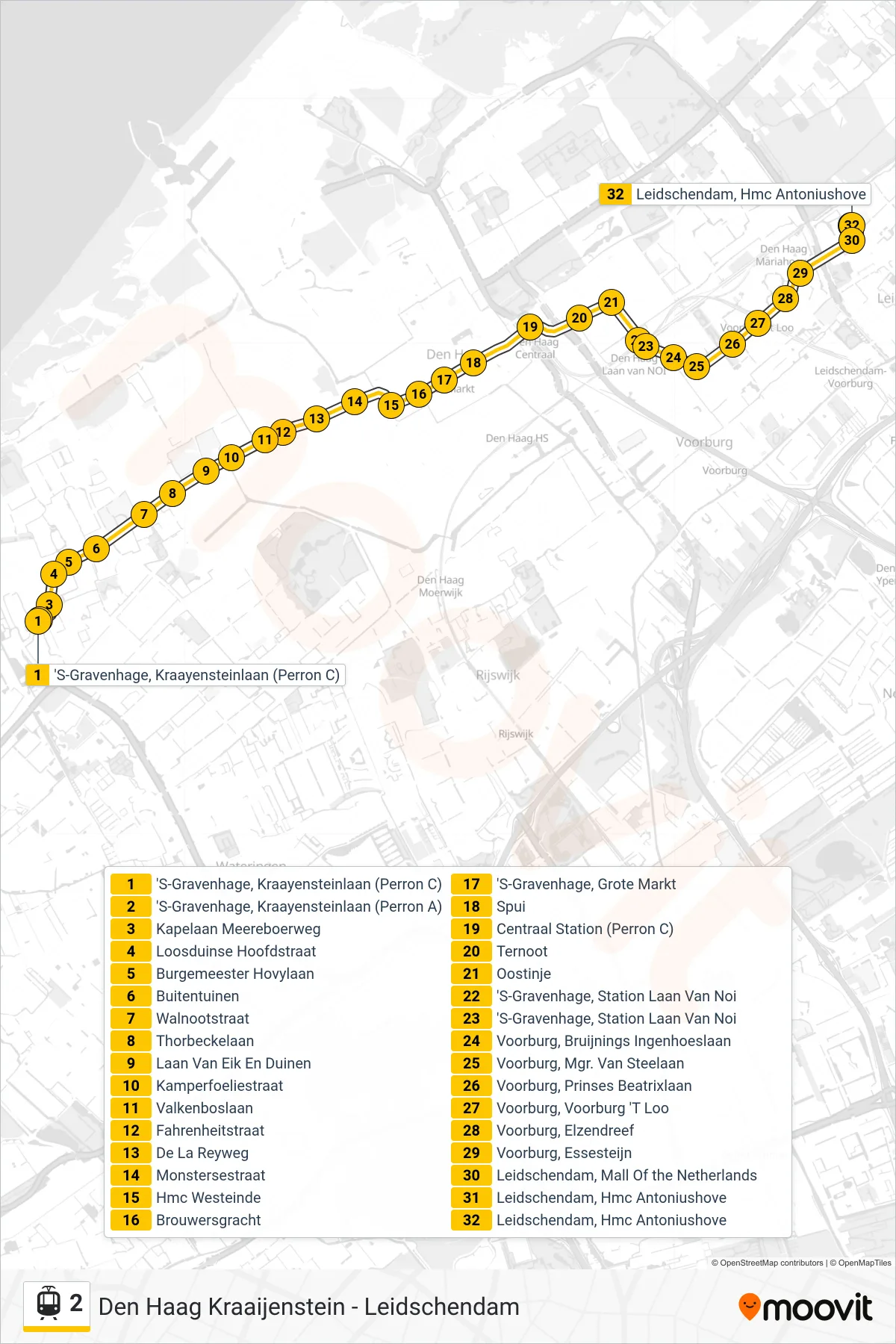
Stops list (2 - Kraayenstein)
- 'S-Gravenhage, Kraayensteinlaan (Perron C)
- 'S-Gravenhage, Kraayensteinlaan (Perron A)
- Kapelaan Meereboerweg
- Loosduinse Hoofdstraat
- Burgemeester Hovylaan
- Buitentuinen
- Walnootstraat
- Thorbeckelaan
- Laan Van Eik En Duinen
- Kamperfoeliestraat
- 'S-Gravenhage, Rijswijkseplein
- De La Reyweg
- Jacob Catsstraat
- 'S-Gravenhage, Wouwermanstraat
- Hoefkade
- Valkenboslaan
- Fahrenheitstraat
- 'S-Gravenhage, Station Hollands Spoor (Perron A)
- Haagse Markt
- Delftselaan
- Monstersestraat
- Hmc Westeinde
- Brouwersgracht
- 'S-Gravenhage, Grote Markt
- Spui
- Centraal Station (Perron C)
- Ternoot
- Oostinje
- 'S-Gravenhage, Station Laan Van Noi
- Voorburg, Bruijnings Ingenhoeslaan
- Voorburg, Mgr. Van Steelaan
- Voorburg, Prinses Beatrixlaan
- Voorburg, Voorburg 'T Loo
- Voorburg, Elzendreef
- Voorburg, Essesteijn
- Leidschendam, Mall Of the Netherlands
- Leidschendam, Hmc Antoniushove
- Leidschendam, Hmc Antoniushove