
2 Bus Route Map
View the 2 route map and see all 2 stops along the route. The map of 2 shows where the bus travels and the location of each stop, making it easy to understand the entire route at a glance.
Explore Stadtwerke Hamm GmbH - Verkehrsbetrieb routes on the map and see where Stadtwerke Hamm GmbH - Verkehrsbetrieb bus services operate. Use the 2 map to find bus stops and see how the 2 connects different areas along its trip.
All 2 stops on the map are displayed in route order, helping you follow the 2 bus from the first stop to the last.
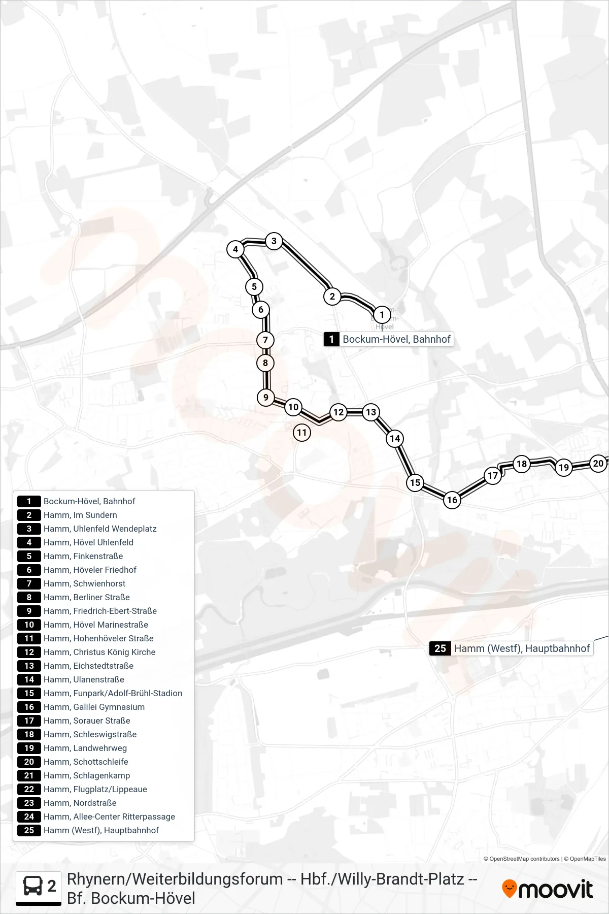
Stops list (2 - Hamm (Westf), Hauptbahnhof Bstg 1+2)
- Bockum-Hövel, Bahnhof
- Hamm, Im Sundern
- Hamm, Uhlenfeld Wendeplatz
- Hamm, Hövel Uhlenfeld
- Hamm, Finkenstraße
- Hamm, Höveler Friedhof
- Hamm, Schwienhorst
- Hamm, Berliner Straße
- Hamm, Friedrich-Ebert-Straße
- Hamm, Hövel Marinestraße
- Hamm, Hohenhöveler Straße
- Hamm, Christus König Kirche
- Hamm, Eichstedtstraße
- Hamm, Ulanenstraße
- Hamm, Funpark/Adolf-Brühl-Stadion
- Hamm, Galilei Gymnasium
- Hamm, Sorauer Straße
- Hamm, Schleswigstraße
- Hamm, Landwehrweg
- Hamm, Schottschleife
- Hamm, Schlagenkamp
- Hamm, Flugplatz/Lippeaue
- Hamm, Nordstraße
- Hamm, Allee-Center Ritterpassage
- Hamm (Westf), Hauptbahnhof