
2 Bus Route Map
View the 2 route map and see all 2 stops along the route. The map of 2 shows where the bus travels and the location of each stop, making it easy to understand the entire route at a glance.
Explore Stadtwerke Hamm GmbH - Verkehrsbetrieb routes on the map and see where Stadtwerke Hamm GmbH - Verkehrsbetrieb bus services operate. Use the 2 map to find bus stops and see how the 2 connects different areas along its trip.
All 2 stops on the map are displayed in route order, helping you follow the 2 bus from the first stop to the last.
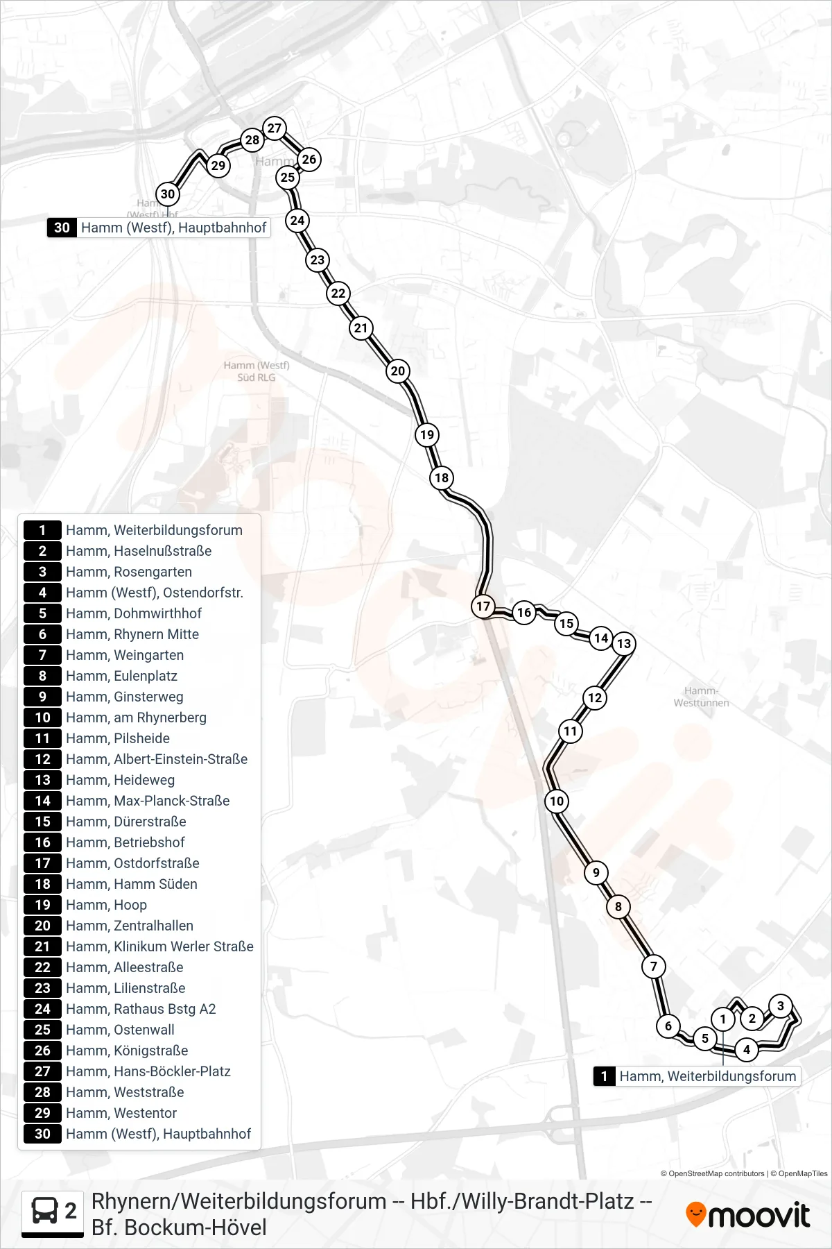
Stops list (2 - Hamm (Westf), Hauptbahnhof Bstg 4+5)
- Hamm, Weiterbildungsforum
- Hamm, Haselnußstraße
- Hamm, Rosengarten
- Hamm (Westf), Ostendorfstr.
- Hamm, Dohmwirthhof
- Hamm, Rhynern Mitte
- Hamm, Weingarten
- Hamm, Eulenplatz
- Hamm, Ginsterweg
- Hamm, am Rhynerberg
- Hamm, Pilsheide
- Hamm, Albert-Einstein-Straße
- Hamm, Heideweg
- Hamm, Max-Planck-Straße
- Hamm, Dürerstraße
- Hamm, Betriebshof
- Hamm, Ostdorfstraße
- Hamm, Hamm Süden
- Hamm, Hoop
- Hamm, Zentralhallen
- Hamm, Klinikum Werler Straße
- Hamm, Alleestraße
- Hamm, Lilienstraße
- Hamm, Rathaus Bstg A2
- Hamm, Ostenwall
- Hamm, Königstraße
- Hamm, Hans-Böckler-Platz
- Hamm, Weststraße
- Hamm, Westentor
- Hamm (Westf), Hauptbahnhof