
20 Bus Route Map
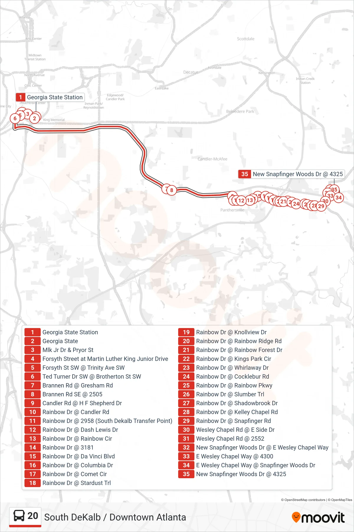
View the 20 route map and see all 20 stops along the route. The map of 20 shows where the bus travels and the location of each stop, making it easy to understand the entire route at a glance.
Explore MARTA routes on the map and see where MARTA bus services operate. Use the 20 map to find bus stops and see how the 20 connects different areas along its trip.
All 20 stops on the map are displayed in route order, helping you follow the 20 bus from the first stop to the last.
Stops list (20 - Snapfinger Wds Dr)
- Georgia State Station
- Georgia State
- Mlk Jr Dr & Pryor St
- Forsyth Street at Martin Luther King Junior Drive
- Forsyth St SW @ Trinity Ave SW
- Ted Turner Dr SW @ Brotherton St SW
- Brannen Rd @ Gresham Rd
- Brannen Rd SE @ 2505
- Candler Rd @ H F Shepherd Dr
- Rainbow Dr @ Candler Rd
- Rainbow Dr @ 2958 (South Dekalb Transfer Point)
- Rainbow Dr @ Dash Lewis Dr
- Rainbow Dr @ Rainbow Cir
- Rainbow Dr @ 3181
- Rainbow Dr @ Da Vinci Blvd
- Rainbow Dr @ Columbia Dr
- Rainbow Dr @ Comet Cir
- Rainbow Dr @ Stardust Trl
- Rainbow Dr @ Knollview Dr
- Rainbow Dr @ Rainbow Ridge Rd
- Rainbow Dr @ Rainbow Forest Dr
- Rainbow Dr @ Kings Park Cir
- Rainbow Dr @ Whirlaway Dr
- Rainbow Dr @ Cocklebur Rd
- Rainbow Dr @ Rainbow Pkwy
- Rainbow Dr @ Slumber Trl
- Rainbow Dr @ Shadowbrook Dr
- Rainbow Dr @ Kelley Chapel Rd
- Rainbow Dr @ Snapfinger Rd
- Wesley Chapel Rd @ E Side Dr
- Wesley Chapel Rd @ 2552
- New Snapfinger Woods Dr @ E Wesley Chapel Way
- E Wesley Chapel Way @ 4300
- E Wesley Chapel Way @ Snapfinger Woods Dr
- New Snapfinger Woods Dr @ 4325