
20 Bus Route Map
View the 20 route map and see all 20 stops along the route. The map of 20 shows where the bus travels and the location of each stop, making it easy to understand the entire route at a glance.
Explore Transit Services of Frederick County routes on the map and see where Transit Services of Frederick County bus services operate. Use the 20 map to find bus stops and see how the 20 connects different areas along its trip.
All 20 stops on the map are displayed in route order, helping you follow the 20 bus from the first stop to the last.
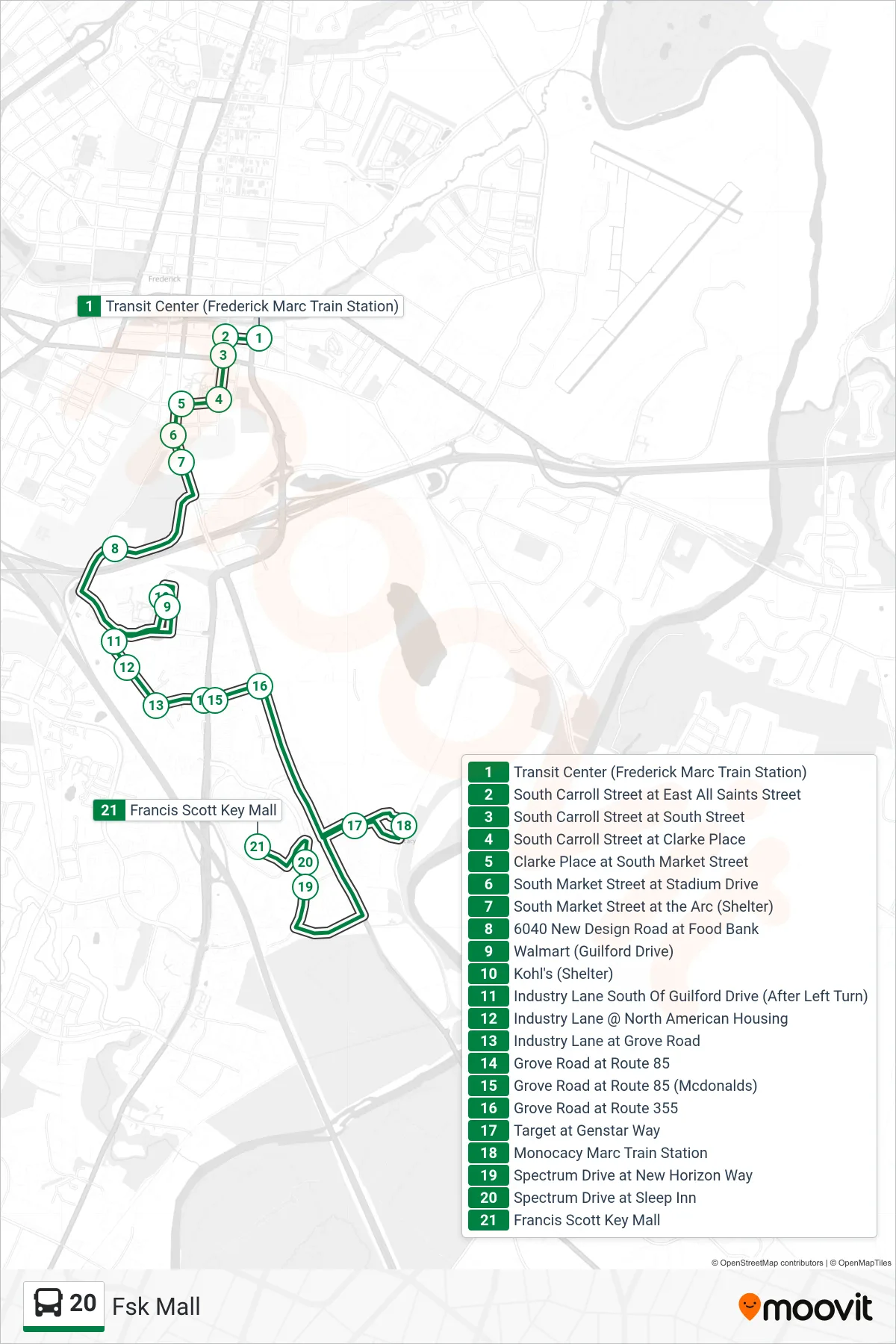
Stops list (20 - Fsk Mall)
- Transit Center (Frederick Marc Train Station)
- South Carroll Street at East All Saints Street
- South Carroll Street at South Street
- South Carroll Street at Clarke Place
- Clarke Place at South Market Street
- South Market Street at Stadium Drive
- South Market Street at the Arc (Shelter)
- 6040 New Design Road at Food Bank
- Walmart (Guilford Drive)
- Kohl's (Shelter)
- Industry Lane South Of Guilford Drive (After Left Turn)
- Industry Lane @ North American Housing
- Industry Lane at Grove Road
- Grove Road at Route 85
- Grove Road at Route 85 (Mcdonalds)
- Grove Road at Route 355
- Target at Genstar Way
- Monocacy Marc Train Station
- Spectrum Drive at New Horizon Way
- Spectrum Drive at Sleep Inn
- Francis Scott Key Mall