
221 Bus Route Map
View the 221 route map and see all 221 stops along the route. The map of 221 shows where the bus travels and the location of each stop, making it easy to understand the entire route at a glance.
Explore PACE routes on the map and see where PACE bus services operate. Use the 221 map to find bus stops and see how the 221 connects different areas along its trip.
All 221 stops on the map are displayed in route order, helping you follow the 221 bus from the first stop to the last.
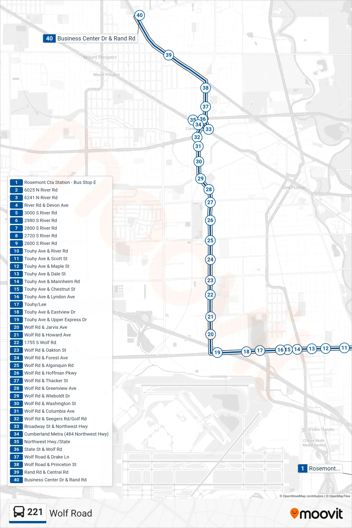
Stops list (221 - Business Center Dr & Rand Rd)
- Rosemont Cta Station - Bus Stop E
- 6025 N River Rd
- 6241 N River Rd
- River Rd & Devon Ave
- 3000 S River Rd
- 2980 S River Rd
- 2800 S River Rd
- 2720 S River Rd
- 2600 S River Rd
- Touhy Ave & River Rd
- Touhy Ave & Scott St
- Touhy Ave & Maple St
- Touhy Ave & Dale St
- Touhy Ave & Mannheim Rd
- Touhy Ave & Chestnut St
- Touhy Ave & Lyndon Ave
- Touhy/Lee
- Touhy Ave & Eastview Dr
- Touhy Ave & Upper Express Dr
- Wolf Rd & Jarvis Ave
- Wolf Rd & Howard Ave
- 1755 S Wolf Rd
- Wolf Rd & Oakton St
- Wolf Rd & Forest Ave
- Wolf Rd & Algonquin Rd
- Wolf Rd & Hoffman Pkwy
- Wolf Rd & Thacker St
- Wolf Rd & Greenview Ave
- Wolf Rd & Wieboldt Dr
- Wolf Rd & Washington St
- Wolf Rd & Columbia Ave
- Wolf Rd & Seegers Rd/Golf Rd
- Broadway St & Northwest Hwy
- Cumberland Metra (484 Northwest Hwy)
- Northwest Hwy./State
- State St & Wolf Rd
- Wolf Road & Drake Ln
- Wolf Road & Princeton St
- Rand Rd & Central Rd
- Business Center Dr & Rand Rd