
221 Bus Route Map
View the 221 route map and see all 221 stops along the route. The map of 221 shows where the bus travels and the location of each stop, making it easy to understand the entire route at a glance.
Explore PACE routes on the map and see where PACE bus services operate. Use the 221 map to find bus stops and see how the 221 connects different areas along its trip.
All 221 stops on the map are displayed in route order, helping you follow the 221 bus from the first stop to the last.
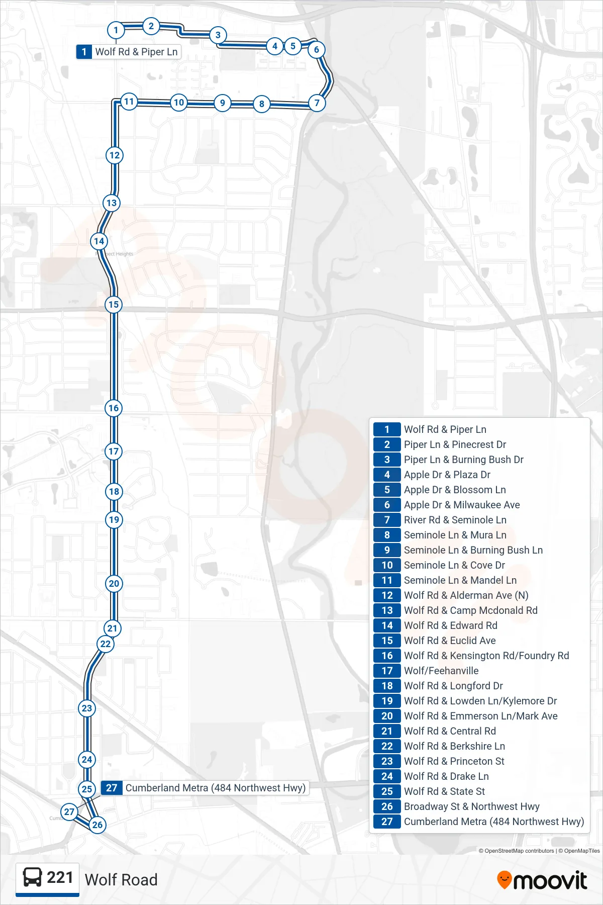
Stops list (221 - Cumberland Metra (484 Northwest Hwy))
- Wolf Rd & Piper Ln
- Piper Ln & Pinecrest Dr
- Piper Ln & Burning Bush Dr
- Apple Dr & Plaza Dr
- Apple Dr & Blossom Ln
- Apple Dr & Milwaukee Ave
- River Rd & Seminole Ln
- Seminole Ln & Mura Ln
- Seminole Ln & Burning Bush Ln
- Seminole Ln & Cove Dr
- Seminole Ln & Mandel Ln
- Wolf Rd & Alderman Ave (N)
- Wolf Rd & Camp Mcdonald Rd
- Wolf Rd & Edward Rd
- Wolf Rd & Euclid Ave
- Wolf Rd & Kensington Rd/Foundry Rd
- Wolf/Feehanville
- Wolf Rd & Longford Dr
- Wolf Rd & Lowden Ln/Kylemore Dr
- Wolf Rd & Emmerson Ln/Mark Ave
- Wolf Rd & Central Rd
- Wolf Rd & Berkshire Ln
- Wolf Rd & Princeton St
- Wolf Rd & Drake Ln
- Wolf Rd & State St
- Broadway St & Northwest Hwy
- Cumberland Metra (484 Northwest Hwy)