
2A Bus Route Map
View the 2A route map and see all 2A stops along the route. The map of 2A shows where the bus travels and the location of each stop, making it easy to understand the entire route at a glance.
Explore Rome Transit Department routes on the map and see where Rome Transit Department bus services operate. Use the 2A map to find bus stops and see how the 2A connects different areas along its trip.
All 2A stops on the map are displayed in route order, helping you follow the 2A bus from the first stop to the last.
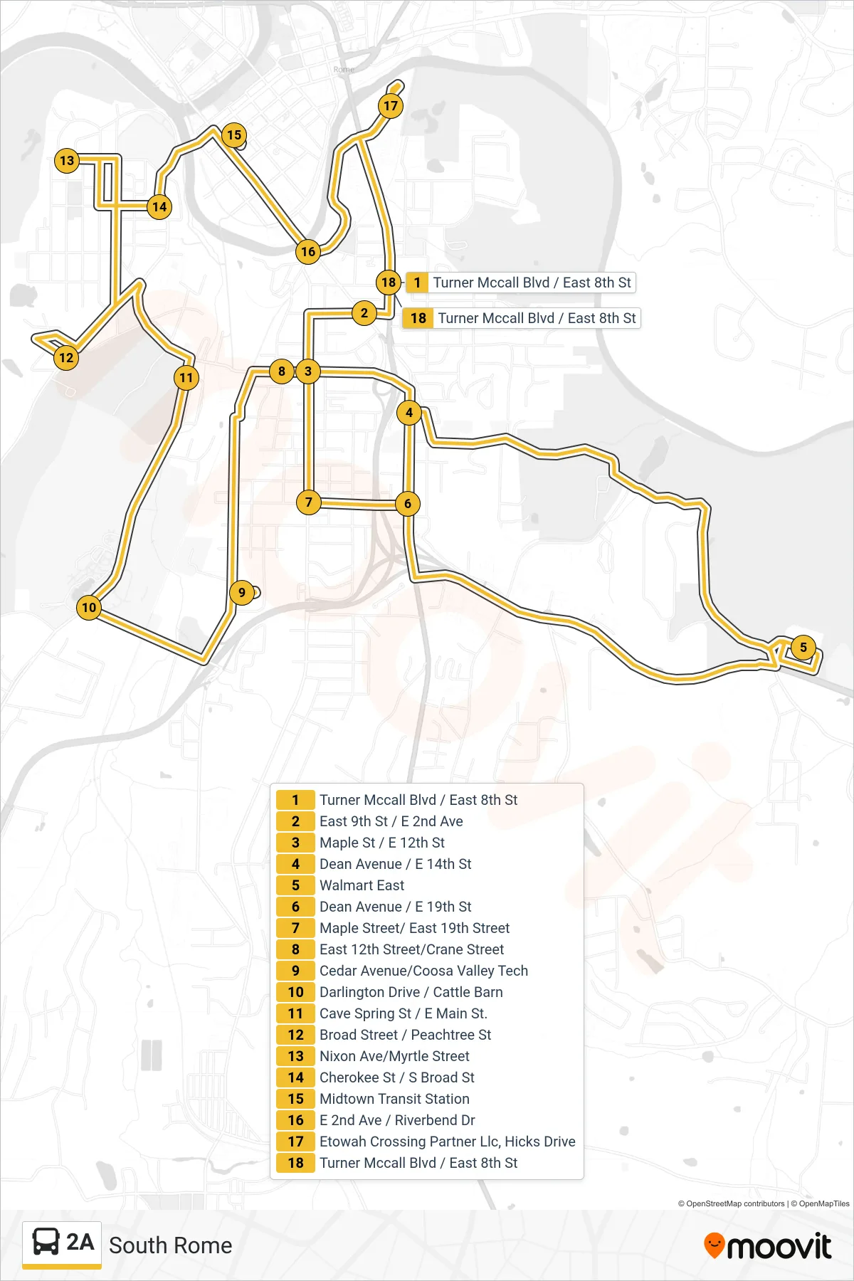
Stops list (2A - South Rome)
- Turner Mccall Blvd / East 8th St
- East 9th St / E 2nd Ave
- Maple St / E 12th St
- Dean Avenue / E 14th St
- Walmart East
- Dean Avenue / E 19th St
- Maple Street/ East 19th Street
- East 12th Street/Crane Street
- Cedar Avenue/Coosa Valley Tech
- Darlington Drive / Cattle Barn
- Cave Spring St / E Main St.
- Broad Street / Peachtree St
- Nixon Ave/Myrtle Street
- Cherokee St / S Broad St
- Midtown Transit Station
- E 2nd Ave / Riverbend Dr
- Etowah Crossing Partner Llc, Hicks Drive
- Turner Mccall Blvd / East 8th St