
35 Bus Route Map
View the 35 route map and see all 35 stops along the route. The map of 35 shows where the bus travels and the location of each stop, making it easy to understand the entire route at a glance.
Explore Rhode Island Public Transit Authority routes on the map and see where Rhode Island Public Transit Authority bus services operate. Use the 35 map to find bus stops and see how the 35 connects different areas along its trip.
All 35 stops on the map are displayed in route order, helping you follow the 35 bus from the first stop to the last.
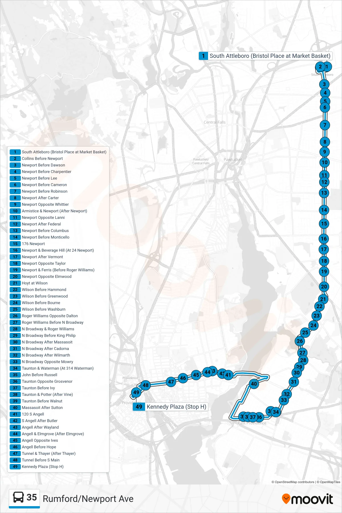
Stops list (35 - Kennedy Plaza)
- South Attleboro (Bristol Place at Market Basket)
- Collins Before Newport
- Newport Before Dawson
- Newport Before Charpentier
- Newport Before Lee
- Newport Before Cameron
- Newport Before Robinson
- Newport After Carter
- Newport Opposite Whittier
- Armistice & Newport (After Newport)
- Newport Opposite Lanni
- Newport After Federal
- Newport Before Columbus
- Newport Before Monticello
- 176 Newport
- Newport & Beverage Hill (At 24 Newport)
- Newport After Vermont
- Newport Opposite Taylor
- Newport & Ferris (Before Roger Williams)
- Newport Opposite Elmwood
- Hoyt at Wilson
- Wilson Before Hammond
- Wilson Before Greenwood
- Wilson Before Bourne
- Wilson Before Washburn
- Roger Williams Opposite Dalton
- Roger Williams Before N Broadway
- N Broadway & Roger Williams
- N Broadway Before King Philip
- N Broadway After Massasoit
- N Broadway After Cadorna
- N Broadway After Wilmarth
- N Broadway Opposite Mowry
- Taunton & Waterman (At 314 Waterman)
- John Before Russell
- Taunton Opposite Grosvenor
- Taunton Before Ivy
- Taunton & Potter (After Vine)
- Taunton Before Walnut
- Massasoit After Sutton
- 120 S Angell
- S Angell After Butler
- Angell After Wayland
- Angell & Elmgrove (After Elmgrove)
- Angell Opposite Ives
- Angell Before Hope
- Tunnel & Thayer (After Thayer)
- Tunnel Before S Main
- Kennedy Plaza (Stop H)