
35 Bus Route Map
View the 35 route map and see all 35 stops along the route. The map of 35 shows where the bus travels and the location of each stop, making it easy to understand the entire route at a glance.
Explore Rhode Island Public Transit Authority routes on the map and see where Rhode Island Public Transit Authority bus services operate. Use the 35 map to find bus stops and see how the 35 connects different areas along its trip.
All 35 stops on the map are displayed in route order, helping you follow the 35 bus from the first stop to the last.
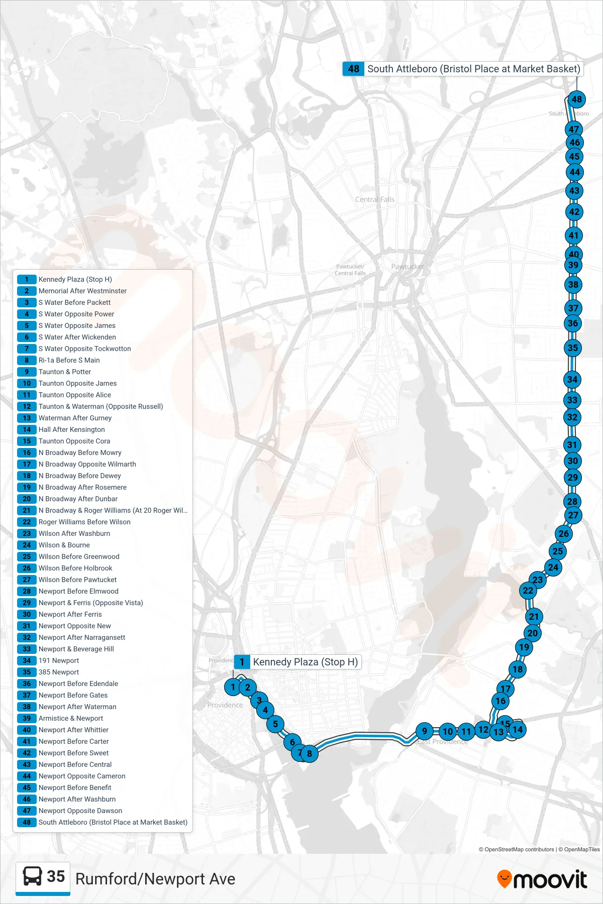
Stops list (35 - South Attleboro Station Via Newport Ave)
- Kennedy Plaza (Stop H)
- Memorial After Westminster
- S Water Before Packett
- S Water Opposite Power
- S Water Opposite James
- S Water After Wickenden
- S Water Opposite Tockwotton
- Ri-1a Before S Main
- Taunton & Potter
- Taunton Opposite James
- Taunton Opposite Alice
- Taunton & Waterman (Opposite Russell)
- Waterman After Gurney
- Hall After Kensington
- Taunton Opposite Cora
- N Broadway Before Mowry
- N Broadway Opposite Wilmarth
- N Broadway Before Dewey
- N Broadway After Rosemere
- N Broadway After Dunbar
- N Broadway & Roger Williams (At 20 Roger Williams)
- Roger Williams Before Wilson
- Wilson After Washburn
- Wilson & Bourne
- Wilson Before Greenwood
- Wilson Before Holbrook
- Wilson Before Pawtucket
- Newport Before Elmwood
- Newport & Ferris (Opposite Vista)
- Newport After Ferris
- Newport Opposite New
- Newport After Narragansett
- Newport & Beverage Hill
- 191 Newport
- 385 Newport
- Newport Before Edendale
- Newport Before Gates
- Newport After Waterman
- Armistice & Newport
- Newport After Whittier
- Newport Before Carter
- Newport Before Sweet
- Newport Before Central
- Newport Opposite Cameron
- Newport Before Benefit
- Newport After Washburn
- Newport Opposite Dawson
- South Attleboro (Bristol Place at Market Basket)