
36 Bus Route Map
View the 36 route map and see all 36 stops along the route. The map of 36 shows where the bus travels and the location of each stop, making it easy to understand the entire route at a glance.
Explore Rīgas satiksme routes on the map and see where Rīgas satiksme bus services operate. Use the 36 map to find bus stops and see how the 36 connects different areas along its trip.
All 36 stops on the map are displayed in route order, helping you follow the 36 bus from the first stop to the last.
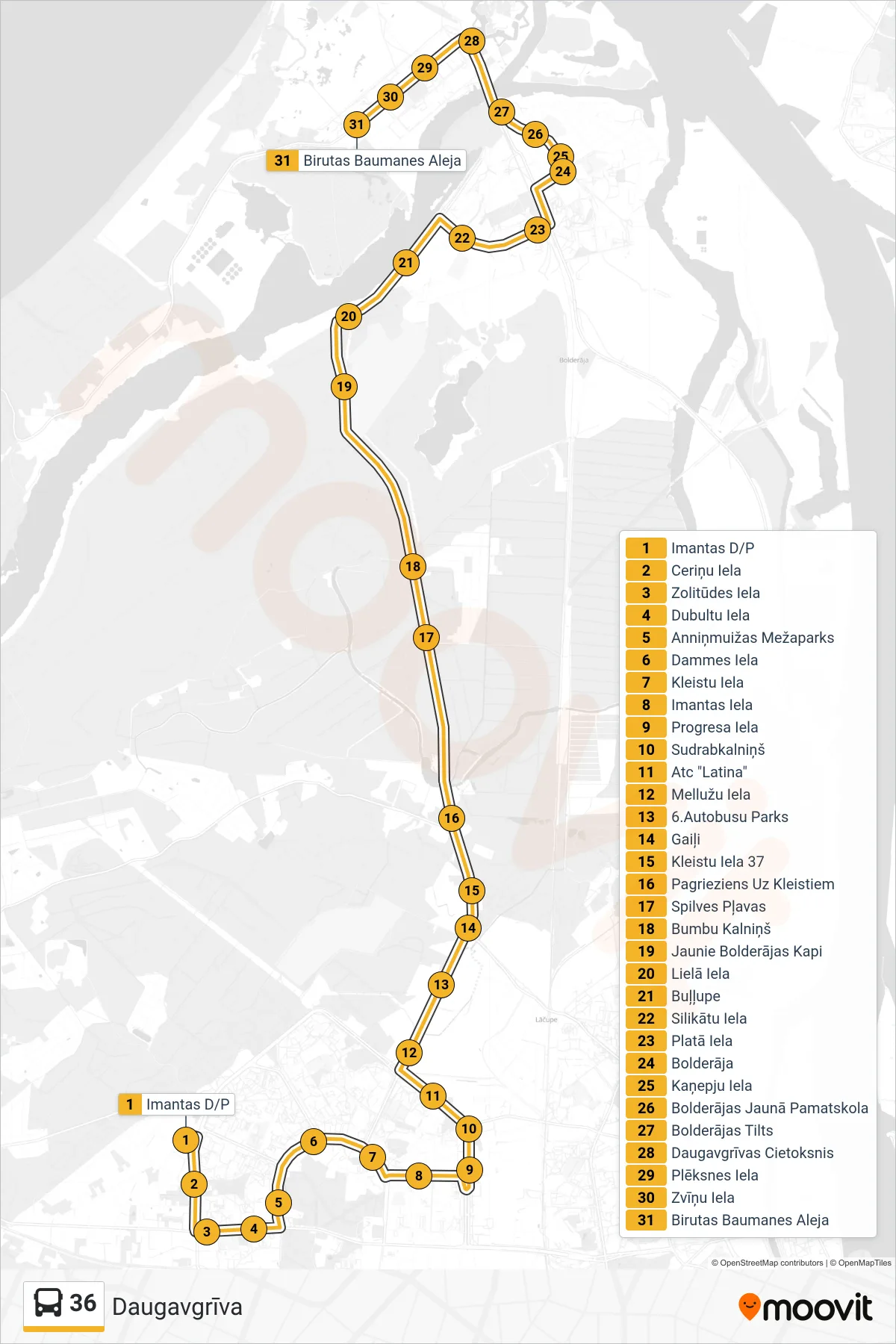
Stops list (36 - Daugavgrīva)
- Imantas D/P
- Ceriņu Iela
- Zolitūdes Iela
- Dubultu Iela
- Anniņmuižas Mežaparks
- Dammes Iela
- Kleistu Iela
- Imantas Iela
- Progresa Iela
- Sudrabkalniņš
- Atc "Latina"
- Mellužu Iela
- 6.Autobusu Parks
- Gaiļi
- Kleistu Iela 37
- Pagrieziens Uz Kleistiem
- Spilves Pļavas
- Bumbu Kalniņš
- Jaunie Bolderājas Kapi
- Lielā Iela
- Buļļupe
- Silikātu Iela
- Platā Iela
- Bolderāja
- Kaņepju Iela
- Bolderājas Jaunā Pamatskola
- Bolderājas Tilts
- Daugavgrīvas Cietoksnis
- Plēksnes Iela
- Zvīņu Iela
- Birutas Baumanes Aleja