
4 Bus Route Map
View the 4 route map and see all 4 stops along the route. The map of 4 shows where the bus travels and the location of each stop, making it easy to understand the entire route at a glance.
Explore Petersburg Area Transit routes on the map and see where Petersburg Area Transit bus services operate. Use the 4 map to find bus stops and see how the 4 connects different areas along its trip.
All 4 stops on the map are displayed in route order, helping you follow the 4 bus from the first stop to the last.
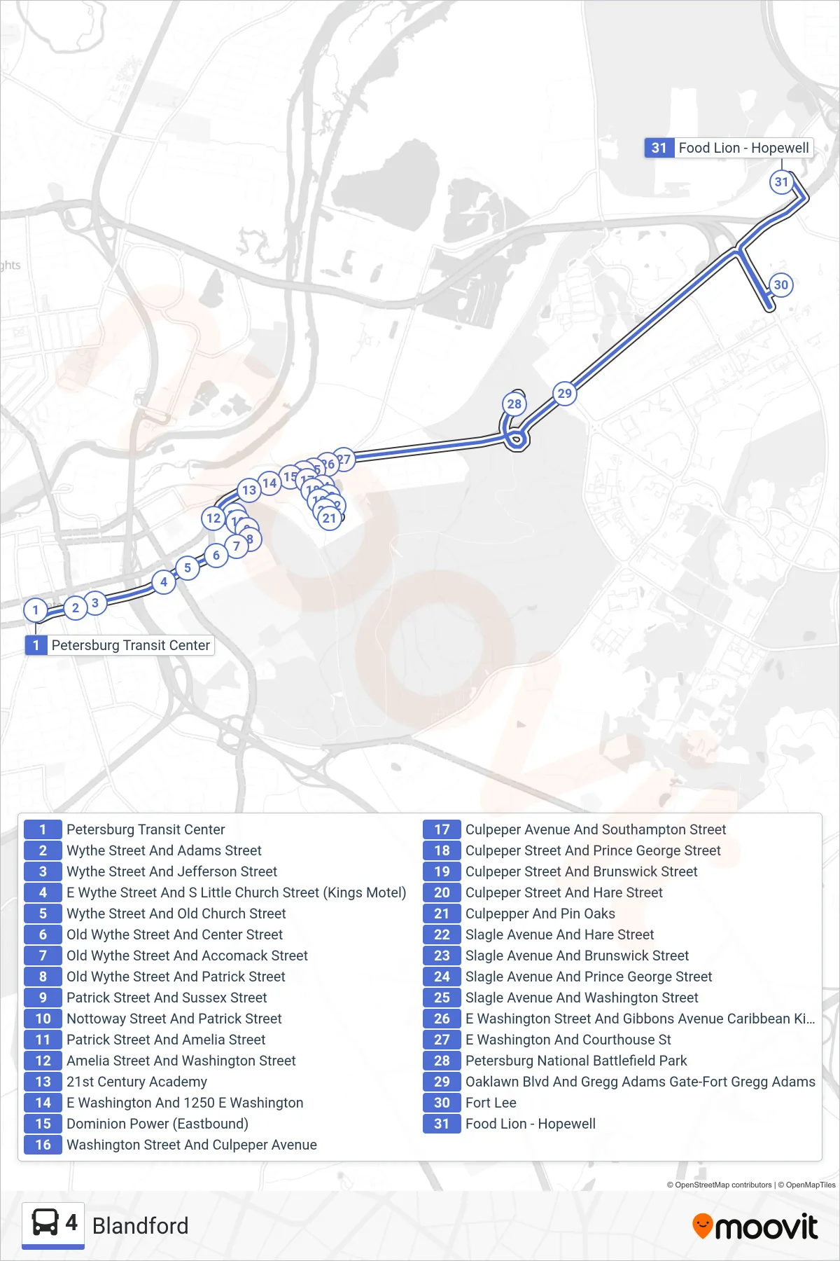
Stops list (4 - Food Lion)
- Petersburg Transit Center
- Wythe Street And Adams Street
- Wythe Street And Jefferson Street
- E Wythe Street And S Little Church Street (Kings Motel)
- Wythe Street And Old Church Street
- Old Wythe Street And Center Street
- Old Wythe Street And Accomack Street
- Old Wythe Street And Patrick Street
- Patrick Street And Sussex Street
- Nottoway Street And Patrick Street
- Patrick Street And Amelia Street
- Amelia Street And Washington Street
- 21st Century Academy
- E Washington And 1250 E Washington
- Dominion Power (Eastbound)
- Washington Street And Culpeper Avenue
- Culpeper Avenue And Southampton Street
- Culpeper Street And Prince George Street
- Culpeper Street And Brunswick Street
- Culpeper Street And Hare Street
- Culpepper And Pin Oaks
- Slagle Avenue And Hare Street
- Slagle Avenue And Brunswick Street
- Slagle Avenue And Prince George Street
- Slagle Avenue And Washington Street
- E Washington Street And Gibbons Avenue Caribbean Kitchen
- E Washington And Courthouse St
- Petersburg National Battlefield Park
- Oaklawn Blvd And Gregg Adams Gate-Fort Gregg Adams
- Fort Lee
- Food Lion - Hopewell