
40 Bus Route Map
View the 40 route map and see all 40 stops along the route. The map of 40 shows where the bus travels and the location of each stop, making it easy to understand the entire route at a glance.
Explore CobbLinc routes on the map and see where CobbLinc bus services operate. Use the 40 map to find bus stops and see how the 40 connects different areas along its trip.
All 40 stops on the map are displayed in route order, helping you follow the 40 bus from the first stop to the last.
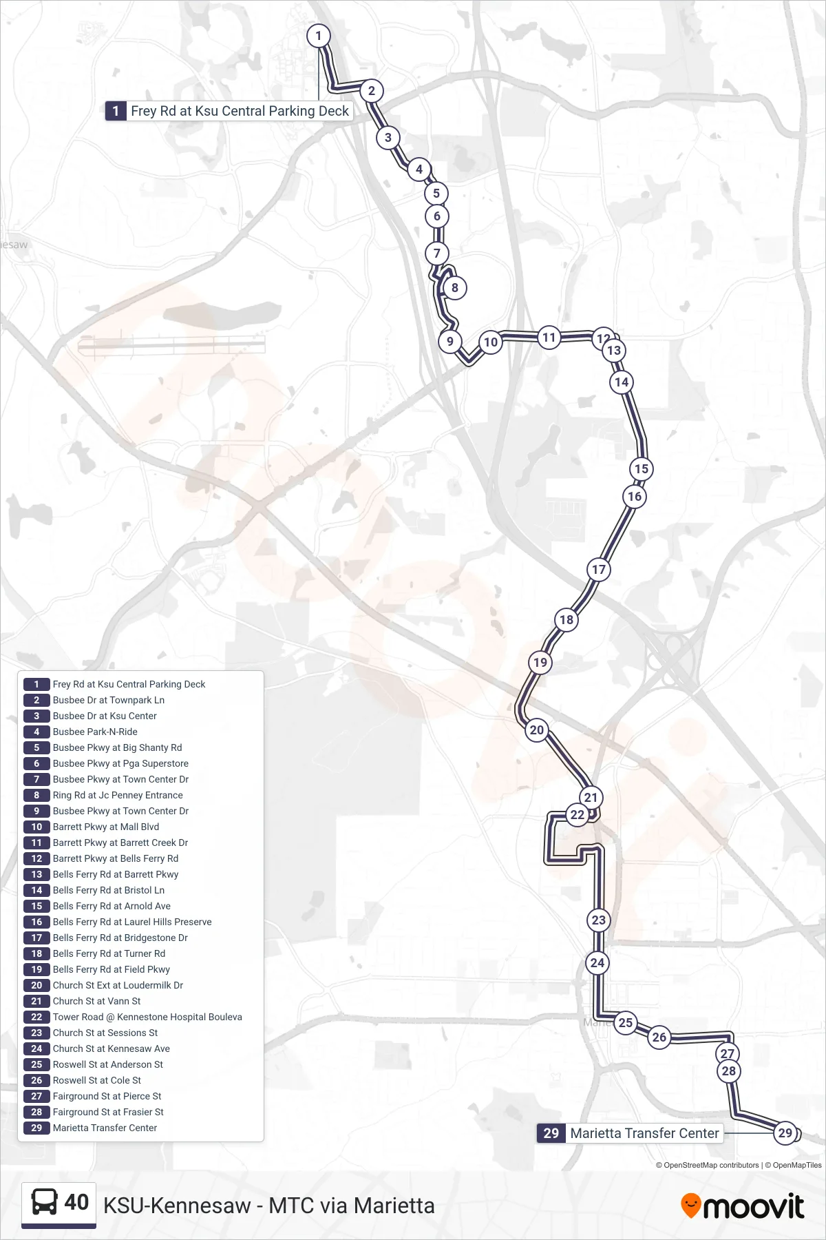
Stops list (40 - Marietta Transfer Center)
- Frey Rd at Ksu Central Parking Deck
- Busbee Dr at Townpark Ln
- Busbee Dr at Ksu Center
- Busbee Park-N-Ride
- Busbee Pkwy at Big Shanty Rd
- Busbee Pkwy at Pga Superstore
- Busbee Pkwy at Town Center Dr
- Ring Rd at Jc Penney Entrance
- Busbee Pkwy at Town Center Dr
- Barrett Pkwy at Mall Blvd
- Barrett Pkwy at Barrett Creek Dr
- Barrett Pkwy at Bells Ferry Rd
- Bells Ferry Rd at Barrett Pkwy
- Bells Ferry Rd at Bristol Ln
- Bells Ferry Rd at Arnold Ave
- Bells Ferry Rd at Laurel Hills Preserve
- Bells Ferry Rd at Bridgestone Dr
- Bells Ferry Rd at Turner Rd
- Bells Ferry Rd at Field Pkwy
- Church St Ext at Loudermilk Dr
- Church St at Vann St
- Tower Road @ Kennestone Hospital Bouleva
- Church St at Sessions St
- Church St at Kennesaw Ave
- Roswell St at Anderson St
- Roswell St at Cole St
- Fairground St at Pierce St
- Fairground St at Frasier St
- Marietta Transfer Center