
41 Bus Route Map
View the 41 route map and see all 41 stops along the route. The map of 41 shows where the bus travels and the location of each stop, making it easy to understand the entire route at a glance.
Explore MBTA routes on the map and see where MBTA bus services operate. Use the 41 map to find bus stops and see how the 41 connects different areas along its trip.
All 41 stops on the map are displayed in route order, helping you follow the 41 bus from the first stop to the last.
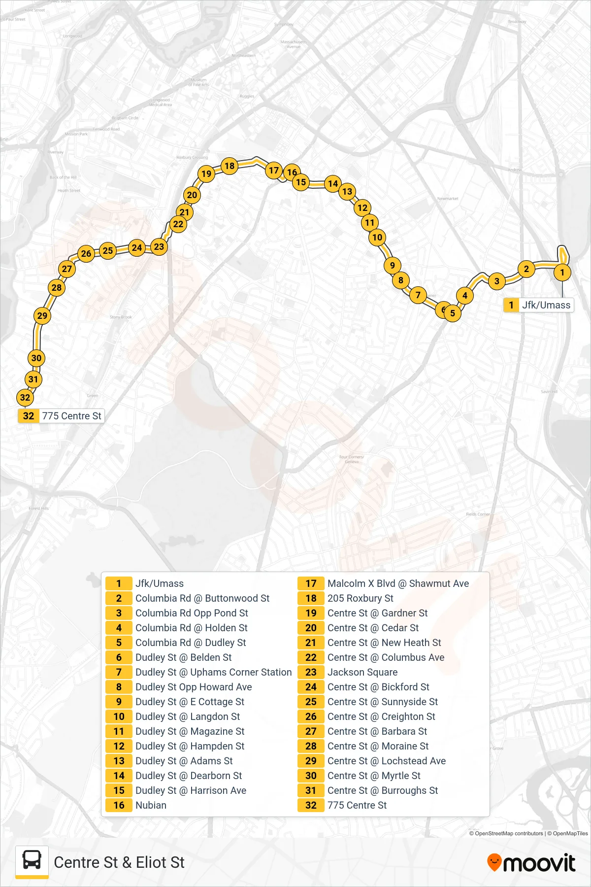
Stops list (41 - Centre St & Eliot St)
- Jfk/Umass
- Columbia Rd @ Buttonwood St
- Columbia Rd Opp Pond St
- Columbia Rd @ Holden St
- Columbia Rd @ Dudley St
- Dudley St @ Belden St
- Dudley St @ Uphams Corner Station
- Dudley St Opp Howard Ave
- Dudley St @ E Cottage St
- Dudley St @ Langdon St
- Dudley St @ Magazine St
- Dudley St @ Hampden St
- Dudley St @ Adams St
- Dudley St @ Dearborn St
- Dudley St @ Harrison Ave
- Nubian
- Malcolm X Blvd @ Shawmut Ave
- 205 Roxbury St
- Centre St @ Gardner St
- Centre St @ Cedar St
- Centre St @ New Heath St
- Centre St @ Columbus Ave
- Jackson Square
- Centre St @ Bickford St
- Centre St @ Sunnyside St
- Centre St @ Creighton St
- Centre St @ Barbara St
- Centre St @ Moraine St
- Centre St @ Lochstead Ave
- Centre St @ Myrtle St
- Centre St @ Burroughs St
- 775 Centre St