
41 Bus Route Map
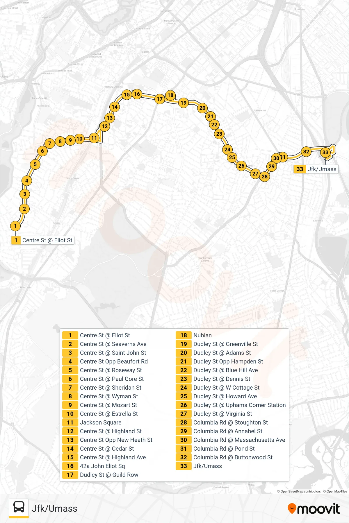
View the 41 route map and see all 41 stops along the route. The map of 41 shows where the bus travels and the location of each stop, making it easy to understand the entire route at a glance.
Explore MBTA routes on the map and see where MBTA bus services operate. Use the 41 map to find bus stops and see how the 41 connects different areas along its trip.
All 41 stops on the map are displayed in route order, helping you follow the 41 bus from the first stop to the last.
Stops list (41 - Jfk/Umass)
- Centre St @ Eliot St
- Centre St @ Seaverns Ave
- Centre St @ Saint John St
- Centre St Opp Beaufort Rd
- Centre St @ Roseway St
- Centre St @ Paul Gore St
- Centre St @ Sheridan St
- Centre St @ Wyman St
- Centre St @ Mozart St
- Centre St @ Estrella St
- Jackson Square
- Centre St @ Highland St
- Centre St Opp New Heath St
- Centre St @ Cedar St
- Centre St @ Highland Ave
- 42a John Eliot Sq
- Dudley St @ Guild Row
- Nubian
- Dudley St @ Greenville St
- Dudley St @ Adams St
- Dudley St Opp Hampden St
- Dudley St @ Blue Hill Ave
- Dudley St @ Dennis St
- Dudley St @ W Cottage St
- Dudley St @ Howard Ave
- Dudley St @ Uphams Corner Station
- Dudley St @ Virginia St
- Columbia Rd @ Stoughton St
- Columbia Rd @ Annabel St
- Columbia Rd @ Massachusetts Ave
- Columbia Rd @ Pond St
- Columbia Rd @ Buttonwood St
- Jfk/Umass