
41 Bus Route Map
View the 41 route map and see all 41 stops along the route. The map of 41 shows where the bus travels and the location of each stop, making it easy to understand the entire route at a glance.
Explore ALIANZA DE CAMIONEROS DE YUCATÁN, A.C. routes on the map and see where ALIANZA DE CAMIONEROS DE YUCATÁN, A.C. bus services operate. Use the 41 map to find bus stops and see how the 41 connects different areas along its trip.
All 41 stops on the map are displayed in route order, helping you follow the 41 bus from the first stop to the last.
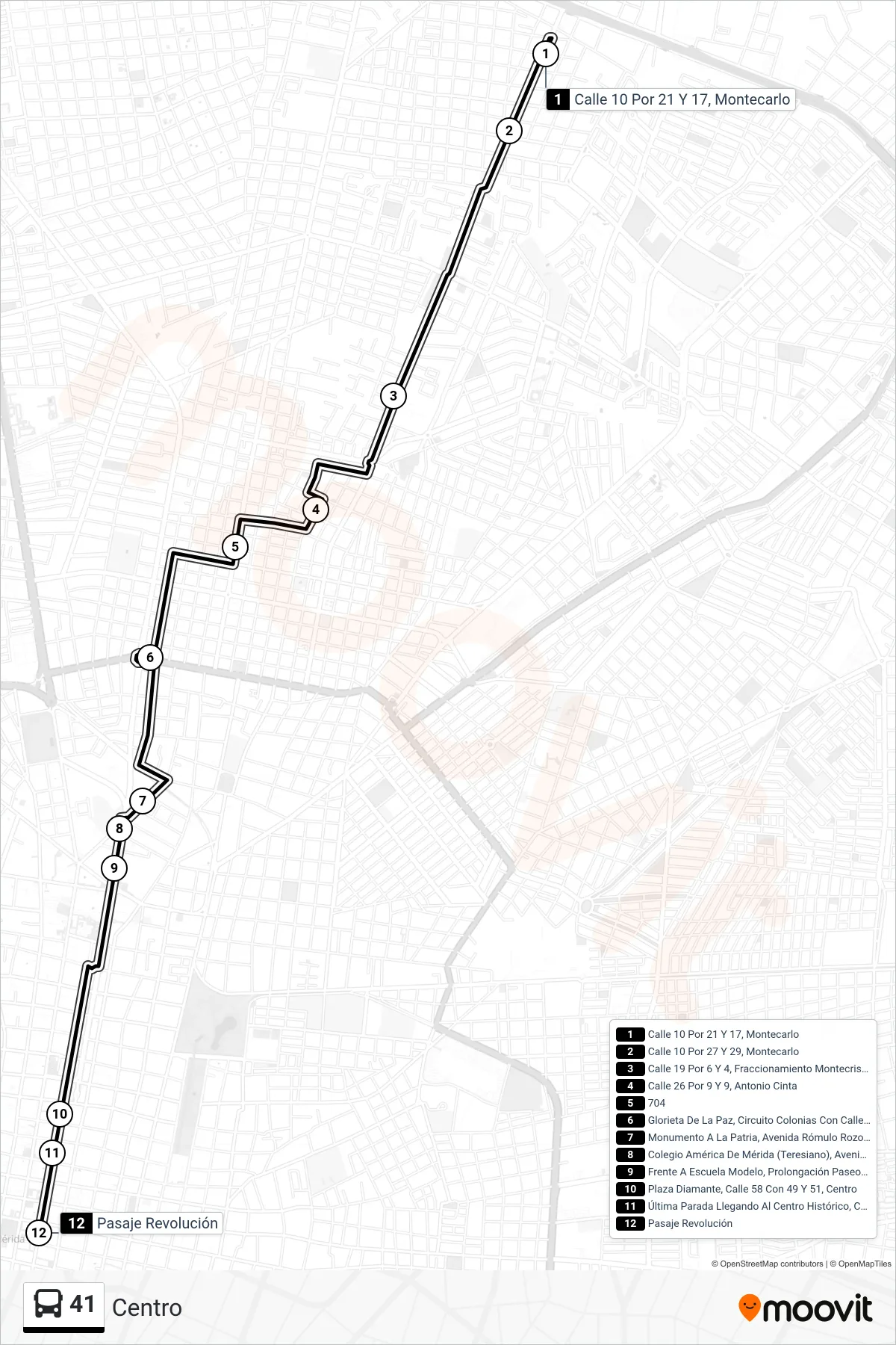
Stops list (41 - Centro)
- Calle 10 Por 21 Y 17, Montecarlo
- Calle 10 Por 27 Y 29, Montecarlo
- Calle 19 Por 6 Y 4, Fraccionamiento Montecristo
- Calle 26 Por 9 Y 9, Antonio Cinta
- 704
- Glorieta De La Paz, Circuito Colonias Con Calle 28 Y 30, Colonia México
- Monumento A La Patria, Avenida Rómulo Rozo Con Prolongación Paseo De Montejo
- Colegio América De Mérida (Teresiano), Avenida Carlos Torre Repetto Por 29 Y 27a
- Frente A Escuela Modelo, Prolongación Paseo De Montejo Por Calle 29a Y 33
- Plaza Diamante, Calle 58 Con 49 Y 51, Centro
- Última Parada Llegando Al Centro Histórico, Calle 58 Por 53 Y 55, Centro
- Pasaje Revolución