
41 Bus Route Map
View the 41 route map and see all 41 stops along the route. The map of 41 shows where the bus travels and the location of each stop, making it easy to understand the entire route at a glance.
Explore ALIANZA DE CAMIONEROS DE YUCATÁN, A.C. routes on the map and see where ALIANZA DE CAMIONEROS DE YUCATÁN, A.C. bus services operate. Use the 41 map to find bus stops and see how the 41 connects different areas along its trip.
All 41 stops on the map are displayed in route order, helping you follow the 41 bus from the first stop to the last.
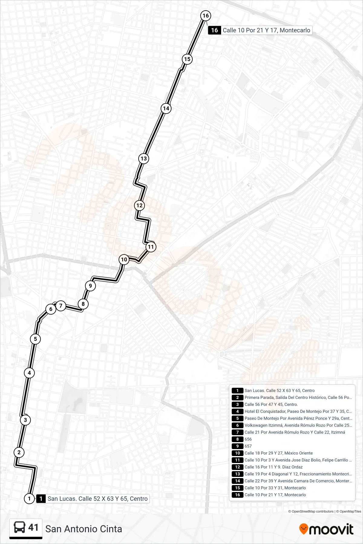
Stops list (41 - San Antonio Cinta)
- San Lucas. Calle 52 X 63 Y 65, Centro
- Primera Parada, Salida Del Centro Histórico, Calle 56 Por 55 Y 53, Centro
- Calle 56 Por 47 Y 45, Centro.
- Hotel El Conquistador, Paseo De Montejo Por 37 Y 35, Centro
- Paseo De Montejo Por Avenida Pérez Ponce Y 29a, Centro
- Volkswagen Itzimná, Avenida Rómulo Rozo Por Calle 25a Y 21, Itzimná
- Calle 21 Por Avenida Rómulo Rozo Y Calle 22, Itzimná
- 656
- 657
- Calle 18 Por 29 Y 27, México Oriente
- Calle 10 Por 3 Y Avenida Jose Diaz Bolio, Felipe Carrillo Puerto
- Calle 16 Por 11 Y 9. Diaz Ordaz
- Calle 19 Por 4 Diagonal Y 12, Fraccionamiento Montecristo
- Calle 22 Por 39 Y Avenida Camara De Comercio, Monterreal
- Calle 10 Por 33 Y 31, Montecarlo
- Calle 10 Por 21 Y 17, Montecarlo