
43 Bus Route Map
View the 43 route map and see all 43 stops along the route. The map of 43 shows where the bus travels and the location of each stop, making it easy to understand the entire route at a glance.
Explore Bus Átha Cliath – Dublin Bus routes on the map and see where Bus Átha Cliath – Dublin Bus bus services operate. Use the 43 map to find bus stops and see how the 43 connects different areas along its trip.
All 43 stops on the map are displayed in route order, helping you follow the 43 bus from the first stop to the last.
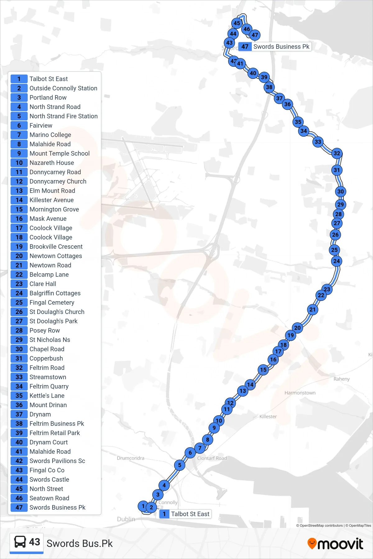
Stops list (43 - Swords Bus.Pk)
- Talbot St East
- Outside Connolly Station
- Portland Row
- North Strand Road
- North Strand Fire Station
- Fairview
- Marino College
- Malahide Road
- Mount Temple School
- Nazareth House
- Donnycarney Road
- Donnycarney Church
- Elm Mount Road
- Killester Avenue
- Mornington Grove
- Mask Avenue
- Coolock Village
- Coolock Village
- Brookville Crescent
- Newtown Cottages
- Newtown Road
- Belcamp Lane
- Clare Hall
- Balgriffin Cottages
- Fingal Cemetery
- St Doulagh's Church
- St Doolagh's Park
- Posey Row
- St Nicholas Ns
- Chapel Road
- Copperbush
- Feltrim Road
- Streamstown
- Feltrim Quarry
- Kettle's Lane
- Mount Drinan
- Drynam
- Feltrim Business Pk
- Feltrim Retail Park
- Drynam Court
- Malahide Road
- Swords Pavilions Sc
- Fingal Co Co
- Swords Castle
- North Street
- Seatown Road
- Swords Business Pk