
47 Bus Route Map
View the 47 route map and see all 47 stops along the route. The map of 47 shows where the bus travels and the location of each stop, making it easy to understand the entire route at a glance.
Explore Bus Átha Cliath – Dublin Bus routes on the map and see where Bus Átha Cliath – Dublin Bus bus services operate. Use the 47 map to find bus stops and see how the 47 connects different areas along its trip.
All 47 stops on the map are displayed in route order, helping you follow the 47 bus from the first stop to the last.
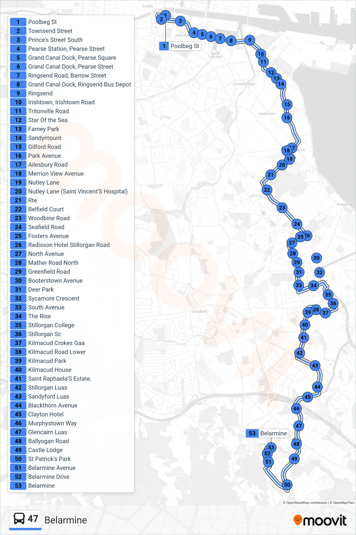
Stops list (47 - Belarmine)
- Poolbeg St
- Townsend Street
- Prince's Street South
- Pearse Station, Pearse Street
- Grand Canal Dock, Pearse Square
- Grand Canal Dock, Pearse Street
- Ringsend Road, Barrow Street
- Grand Canal Dock, Ringsend Bus Depot
- Ringsend
- Irishtown, Irishtown Road
- Tritonville Road
- Star Of the Sea
- Farney Park
- Sandymount
- Gilford Road
- Park Avenue
- Ailesbury Road
- Merrion View Avenue
- Nutley Lane
- Nutley Lane (Saint Vincent'S Hospital)
- Rte
- Belfield Court
- Woodbine Road
- Seafield Road
- Fosters Avenue
- Radisson Hotel Stillorgan Road
- North Avenue
- Mather Road North
- Greenfield Road
- Booterstown Avenue
- Deer Park
- Sycamore Crescent
- South Avenue
- The Rise
- Stillorgan College
- Stillorgan Sc
- Kilmacud Crokes Gaa
- Kilmacud Road Lower
- Kilmacud Park
- Kilmacud House
- Saint Raphaela'S Estate.
- Stillorgan Luas
- Sandyford Luas
- Blackthorn Avenue
- Clayton Hotel
- Murphystown Way
- Glencairn Luas
- Ballyogan Road
- Castle Lodge
- St Patrick's Park
- Belarmine Avenue
- Belarmine Drive
- Belarmine