
47 Bus Route Map
View the 47 route map and see all 47 stops along the route. The map of 47 shows where the bus travels and the location of each stop, making it easy to understand the entire route at a glance.
Explore Bus Átha Cliath – Dublin Bus routes on the map and see where Bus Átha Cliath – Dublin Bus bus services operate. Use the 47 map to find bus stops and see how the 47 connects different areas along its trip.
All 47 stops on the map are displayed in route order, helping you follow the 47 bus from the first stop to the last.
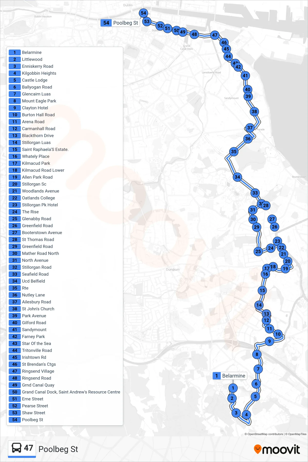
Stops list (47 - Poolbeg St)
- Belarmine
- Littlewood
- Enniskerry Road
- Kilgobbin Heights
- Castle Lodge
- Ballyogan Road
- Glencairn Luas
- Mount Eagle Park
- Clayton Hotel
- Burton Hall Road
- Arena Road
- Carmanhall Road
- Blackthorn Drive
- Stillorgan Luas
- Saint Raphaela'S Estate.
- Whately Place
- Kilmacud Park
- Kilmacud Road Lower
- Allen Park Road
- Stillorgan Sc
- Woodlands Avenue
- Oatlands College
- Stillorgan Pk Hotel
- The Rise
- Glenabby Road
- Greenfield Road
- Booterstown Avenue
- St Thomas Road
- Greenfield Road
- Mather Road North
- North Avenue
- Stillorgan Road
- Seafield Road
- Ucd Belfield
- Rte
- Nutley Lane
- Ailesbury Road
- St John's Church
- Park Avenue
- Gilford Road
- Sandymount
- Farney Park
- Star Of the Sea
- Tritonville Road
- Irishtown Rd
- St Brendan's Ctgs
- Ringsend Village
- Ringsend Road
- Grnd Canal Quay
- Grand Canal Dock, Saint Andrew's Resource Centre
- Erne Street
- Pearse Street
- Shaw Street
- Poolbeg St