
546 Bus Route Map
View the 546 route map and see all 546 stops along the route. The map of 546 shows where the bus travels and the location of each stop, making it easy to understand the entire route at a glance.
Explore PACE routes on the map and see where PACE bus services operate. Use the 546 map to find bus stops and see how the 546 connects different areas along its trip.
All 546 stops on the map are displayed in route order, helping you follow the 546 bus from the first stop to the last.
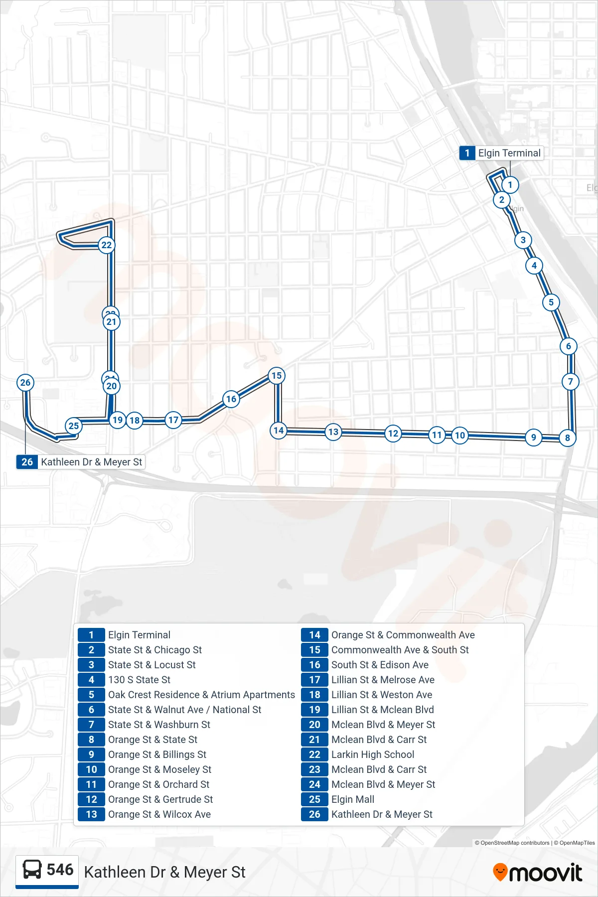
Stops list (546 - Kathleen Dr & Meyer St)
- Elgin Terminal
- State St & Chicago St
- State St & Locust St
- 130 S State St
- Oak Crest Residence & Atrium Apartments
- State St & Walnut Ave / National St
- State St & Washburn St
- Orange St & State St
- Orange St & Billings St
- Orange St & Moseley St
- Orange St & Orchard St
- Orange St & Gertrude St
- Orange St & Wilcox Ave
- Orange St & Commonwealth Ave
- Commonwealth Ave & South St
- South St & Edison Ave
- Lillian St & Melrose Ave
- Lillian St & Weston Ave
- Lillian St & Mclean Blvd
- Mclean Blvd & Meyer St
- Mclean Blvd & Carr St
- Larkin High School
- Mclean Blvd & Carr St
- Mclean Blvd & Meyer St
- Elgin Mall
- Kathleen Dr & Meyer St