
571 Bus Route Map
View the 571 route map and see all 571 stops along the route. The map of 571 shows where the bus travels and the location of each stop, making it easy to understand the entire route at a glance.
Explore PACE routes on the map and see where PACE bus services operate. Use the 571 map to find bus stops and see how the 571 connects different areas along its trip.
All 571 stops on the map are displayed in route order, helping you follow the 571 bus from the first stop to the last.
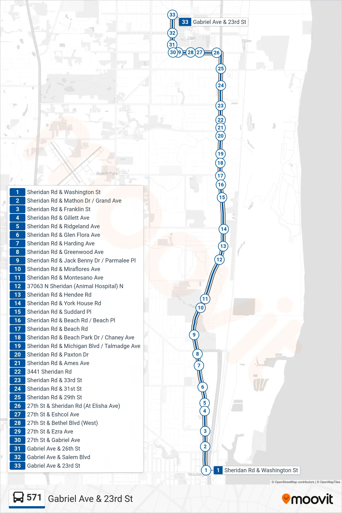
Stops list (571 - Gabriel Ave & 23rd St)
- Sheridan Rd & Washington St
- Sheridan Rd & Mathon Dr / Grand Ave
- Sheridan Rd & Franklin St
- Sheridan Rd & Gillett Ave
- Sheridan Rd & Ridgeland Ave
- Sheridan Rd & Glen Flora Ave
- Sheridan Rd & Harding Ave
- Sheridan Rd & Greenwood Ave
- Sheridan Rd & Jack Benny Dr / Parmalee Pl
- Sheridan Rd & Miraflores Ave
- Sheridan Rd & Montesano Ave
- 37063 N Sheridan (Animal Hospital) N
- Sheridan Rd & Hendee Rd
- Sheridan Rd & York House Rd
- Sheridan Rd & Suddard Pl
- Sheridan Rd & Beach Rd / Beach Pl
- Sheridan Rd & Beach Rd
- Sheridan Rd & Beach Park Dr / Chaney Ave
- Sheridan Rd & Michigan Blvd / Talmadge Ave
- Sheridan Rd & Paxton Dr
- Sheridan Rd & Ames Ave
- 3441 Sheridan Rd
- Sheridan Rd & 33rd St
- Sheridan Rd & 31st St
- Sheridan Rd & 29th St
- 27th St & Sheridan Rd (At Elisha Ave)
- 27th St & Eshcol Ave
- 27th St & Bethel Blvd (West)
- 27th St & Ezra Ave
- 27th St & Gabriel Ave
- Gabriel Ave & 26th St
- Gabriel Ave & Salem Blvd
- Gabriel Ave & 23rd St