
66 Bus Route Map
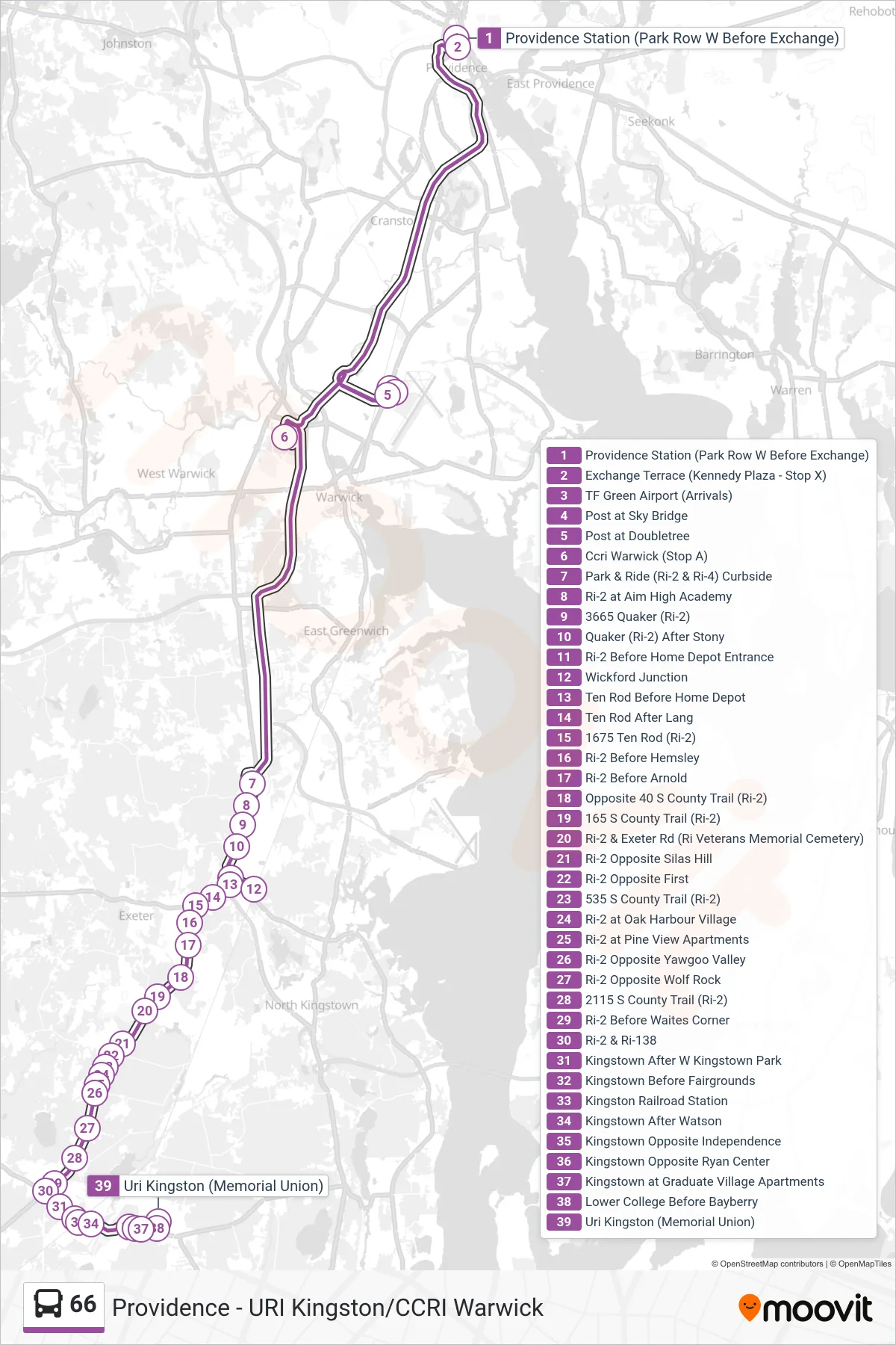
View the 66 route map and see all 66 stops along the route. The map of 66 shows where the bus travels and the location of each stop, making it easy to understand the entire route at a glance.
Explore Rhode Island Public Transit Authority routes on the map and see where Rhode Island Public Transit Authority bus services operate. Use the 66 map to find bus stops and see how the 66 connects different areas along its trip.
All 66 stops on the map are displayed in route order, helping you follow the 66 bus from the first stop to the last.
Stops list (66 - Uri Kingston)
- Providence Station (Park Row W Before Exchange)
- Exchange Terrace (Kennedy Plaza - Stop X)
- TF Green Airport (Arrivals)
- Post at Sky Bridge
- Post at Doubletree
- Ccri Warwick (Stop A)
- Park & Ride (Ri-2 & Ri-4) Curbside
- Ri-2 at Aim High Academy
- 3665 Quaker (Ri-2)
- Quaker (Ri-2) After Stony
- Ri-2 Before Home Depot Entrance
- Wickford Junction
- Ten Rod Before Home Depot
- Ten Rod After Lang
- 1675 Ten Rod (Ri-2)
- Ri-2 Before Hemsley
- Ri-2 Before Arnold
- Opposite 40 S County Trail (Ri-2)
- 165 S County Trail (Ri-2)
- Ri-2 & Exeter Rd (Ri Veterans Memorial Cemetery)
- Ri-2 Opposite Silas Hill
- Ri-2 Opposite First
- 535 S County Trail (Ri-2)
- Ri-2 at Oak Harbour Village
- Ri-2 at Pine View Apartments
- Ri-2 Opposite Yawgoo Valley
- Ri-2 Opposite Wolf Rock
- 2115 S County Trail (Ri-2)
- Ri-2 Before Waites Corner
- Ri-2 & Ri-138
- Kingstown After W Kingstown Park
- Kingstown Before Fairgrounds
- Kingston Railroad Station
- Kingstown After Watson
- Kingstown Opposite Independence
- Kingstown Opposite Ryan Center
- Kingstown at Graduate Village Apartments
- Lower College Before Bayberry
- Uri Kingston (Memorial Union)