
69 Bus Route Map
View the 69 route map and see all 69 stops along the route. The map of 69 shows where the bus travels and the location of each stop, making it easy to understand the entire route at a glance.
Explore Bus Átha Cliath – Dublin Bus routes on the map and see where Bus Átha Cliath – Dublin Bus bus services operate. Use the 69 map to find bus stops and see how the 69 connects different areas along its trip.
All 69 stops on the map are displayed in route order, helping you follow the 69 bus from the first stop to the last.
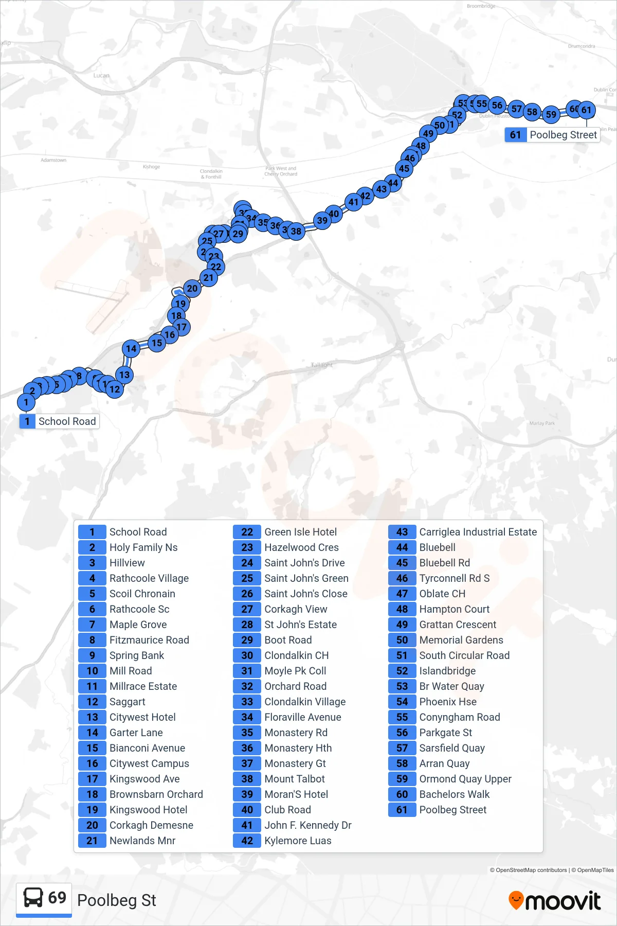
Stops list (69 - Poolbeg St)
- School Road
- Holy Family Ns
- Hillview
- Rathcoole Village
- Scoil Chronain
- Rathcoole Sc
- Maple Grove
- Fitzmaurice Road
- Spring Bank
- Mill Road
- Millrace Estate
- Saggart
- Citywest Hotel
- Garter Lane
- Bianconi Avenue
- Citywest Campus
- Kingswood Ave
- Brownsbarn Orchard
- Kingswood Hotel
- Corkagh Demesne
- Newlands Mnr
- Green Isle Hotel
- Hazelwood Cres
- Saint John's Drive
- Saint John's Green
- Saint John's Close
- Corkagh View
- St John's Estate
- Boot Road
- Clondalkin CH
- Moyle Pk Coll
- Orchard Road
- Clondalkin Village
- Floraville Avenue
- Monastery Rd
- Monastery Hth
- Monastery Gt
- Mount Talbot
- Moran'S Hotel
- Club Road
- John F. Kennedy Dr
- Kylemore Luas
- Carriglea Industrial Estate
- Bluebell
- Bluebell Rd
- Tyrconnell Rd S
- Oblate CH
- Hampton Court
- Grattan Crescent
- Memorial Gardens
- South Circular Road
- Islandbridge
- Br Water Quay
- Phoenix Hse
- Conyngham Road
- Parkgate St
- Sarsfield Quay
- Arran Quay
- Ormond Quay Upper
- Bachelors Walk
- Poolbeg Street