
E Bus Route Map
View the E route map and see all E stops along the route. The map of E shows where the bus travels and the location of each stop, making it easy to understand the entire route at a glance.
Explore ATMA S.c.p.a. routes on the map and see where ATMA S.c.p.a. bus services operate. Use the E map to find bus stops and see how the E connects different areas along its trip.
All E stops on the map are displayed in route order, helping you follow the E bus from the first stop to the last.
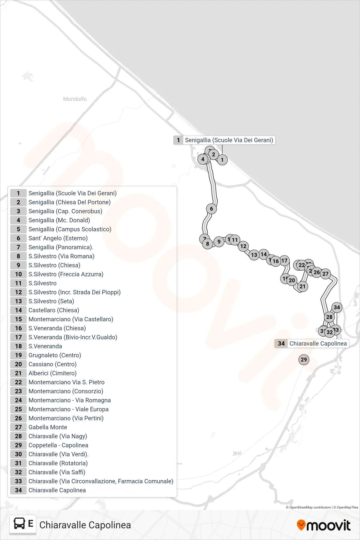
Stops list (E - Chiaravalle Terminal)
- Senigallia (Schools on Gerani Street)
- Senigallia (Portone Church)
- Senigallia (Conerobus Terminal)
- Senigallia (McDonald's)
- Senigallia (School Campus)
- Sant' Angelo (External)
- Senigallia (Panoramic)
- St. Silvestro (Roman Road)
- San Silvestro (Church)
- San Silvestro (Freccia Azzurra)
- S. Silvestro
- S.Silvestro (Poplars Road Intersection)
- S.Silvestro (Seta)
- Castellaro (Church)
- Montemarciano (Castellaro Street)
- Santa Veneranda (Church)
- Santa Veneranda (Gualdo Road Junction)
- St. Veneranda
- Grugnaleto (Center)
- Cassiano (Center)
- Alberici (Cemetery)
- Montemarciano Via San Pietro
- Montemarciano (Consortium)
- Montemarciano - Via Romagna
- Montemarciano - Europa Avenue
- Montemarciano (Pertini Street)
- Upper Gabella
- Chiaravalle (Nagy Street)
- Coppetella - Terminal
- Chiaravalle (Verdi Street)
- Chiaravalle (Roundabout)
- Chiaravalle (Saffi Street)
- Chiaravalle (Ring Road, Municipal Pharmacy)
- Chiaravalle Terminal
Change direction
- Route Map - E - Chiaravalle (Professional Institute)
- Route Map - E - Senigallia (Classical High School)
- Route Map - E - Marina (Terminal)
- Route Map - E - Montemarciano Via San Pietro
- Route Map - E - Chiaravalle Terminal
- Route Map - E - Senigallia (Conerobus Terminal)
- Route Map - E - Coppetella - Terminal
- Route Map - E - Senigallia (Medi High School)
- Route Map - E - Jesi (Bus Station)