
E Bus Route Map
View the E route map and see all E stops along the route. The map of E shows where the bus travels and the location of each stop, making it easy to understand the entire route at a glance.
Explore RVS routes on the map and see where RVS bus services operate. Use the E map to find bus stops and see how the E connects different areas along its trip.
All E stops on the map are displayed in route order, helping you follow the E bus from the first stop to the last.
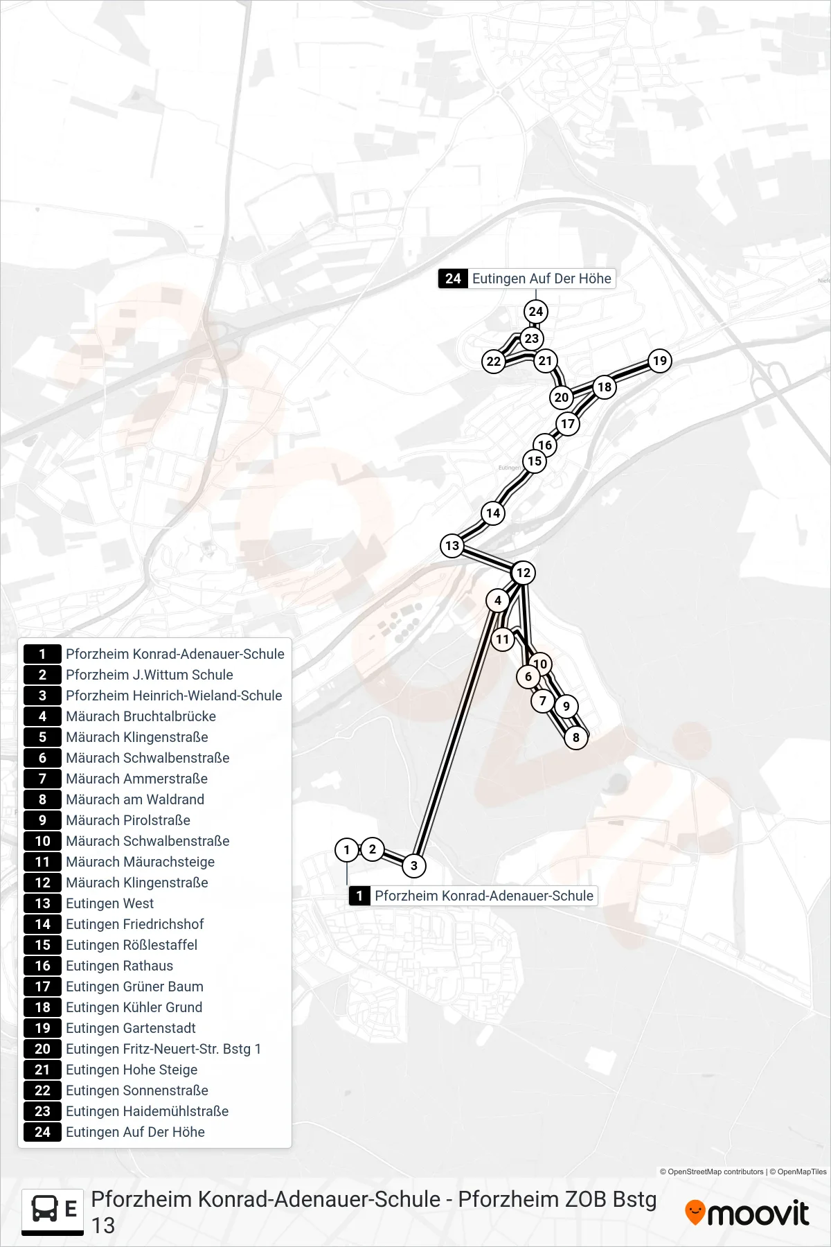
Stops list (E - Eutingen Auf Der Höhe)
- Pforzheim Konrad-Adenauer-Schule
- Pforzheim J.Wittum Schule
- Pforzheim Heinrich-Wieland-Schule
- Mäurach Bruchtalbrücke
- Mäurach Klingenstraße
- Mäurach Schwalbenstraße
- Mäurach Ammerstraße
- Mäurach am Waldrand
- Mäurach Pirolstraße
- Mäurach Schwalbenstraße
- Mäurach Mäurachsteige
- Mäurach Klingenstraße
- Eutingen West
- Eutingen Friedrichshof
- Eutingen Rößlestaffel
- Eutingen Rathaus
- Eutingen Grüner Baum
- Eutingen Kühler Grund
- Eutingen Gartenstadt
- Eutingen Fritz-Neuert-Str. Bstg 1
- Eutingen Hohe Steige
- Eutingen Sonnenstraße
- Eutingen Haidemühlstraße
- Eutingen Auf Der Höhe