
LOOP ROUTE Bus Route Map
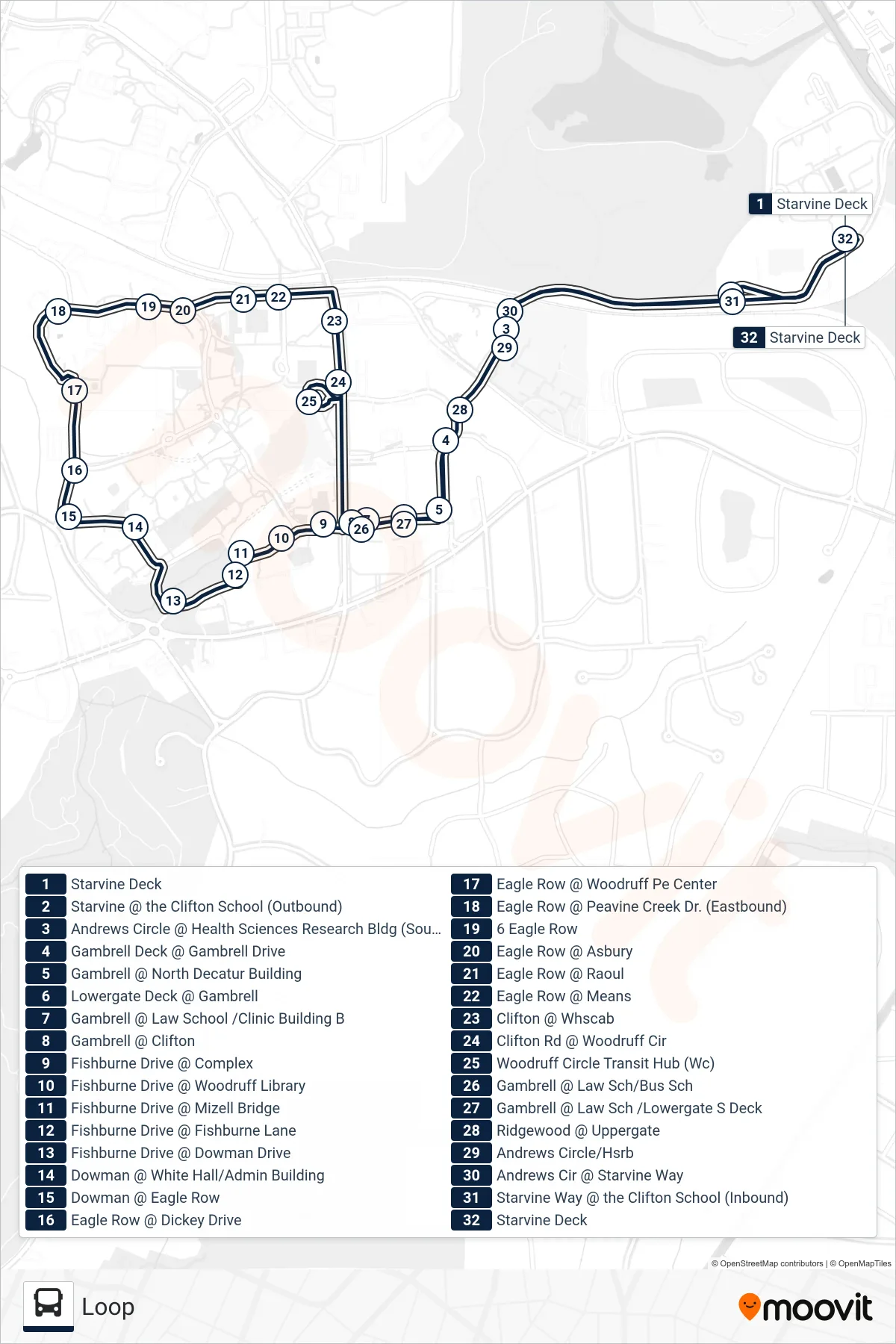
View the LOOP ROUTE route map and see all LOOP ROUTE stops along the route. The map of LOOP ROUTE shows where the bus travels and the location of each stop, making it easy to understand the entire route at a glance.
Explore Emory University Transportation routes on the map and see where Emory University Transportation bus services operate. Use the LOOP ROUTE map to find bus stops and see how the LOOP ROUTE connects different areas along its trip.
All LOOP ROUTE stops on the map are displayed in route order, helping you follow the LOOP ROUTE bus from the first stop to the last.
Stops list (LOOP ROUTE - Loop)
- Starvine Deck
- Starvine @ the Clifton School (Outbound)
- Andrews Circle @ Health Sciences Research Bldg (Southbound)
- Gambrell Deck @ Gambrell Drive
- Gambrell @ North Decatur Building
- Lowergate Deck @ Gambrell
- Gambrell @ Law School /Clinic Building B
- Gambrell @ Clifton
- Fishburne Drive @ Complex
- Fishburne Drive @ Woodruff Library
- Fishburne Drive @ Mizell Bridge
- Fishburne Drive @ Fishburne Lane
- Fishburne Drive @ Dowman Drive
- Dowman @ White Hall/Admin Building
- Dowman @ Eagle Row
- Eagle Row @ Dickey Drive
- Eagle Row @ Woodruff Pe Center
- Eagle Row @ Peavine Creek Dr. (Eastbound)
- 6 Eagle Row
- Eagle Row @ Asbury
- Eagle Row @ Raoul
- Eagle Row @ Means
- Clifton @ Whscab
- Clifton Rd @ Woodruff Cir
- Woodruff Circle Transit Hub (Wc)
- Gambrell @ Law Sch/Bus Sch
- Gambrell @ Law Sch /Lowergate S Deck
- Ridgewood @ Uppergate
- Andrews Circle/Hsrb
- Andrews Cir @ Starvine Way
- Starvine Way @ the Clifton School (Inbound)
- Starvine Deck