
N Bus Route Map
View the N route map and see all N stops along the route. The map of N shows where the bus travels and the location of each stop, making it easy to understand the entire route at a glance.
Explore Chapel Hill Transit routes on the map and see where Chapel Hill Transit bus services operate. Use the N map to find bus stops and see how the N connects different areas along its trip.
All N stops on the map are displayed in route order, helping you follow the N bus from the first stop to the last.
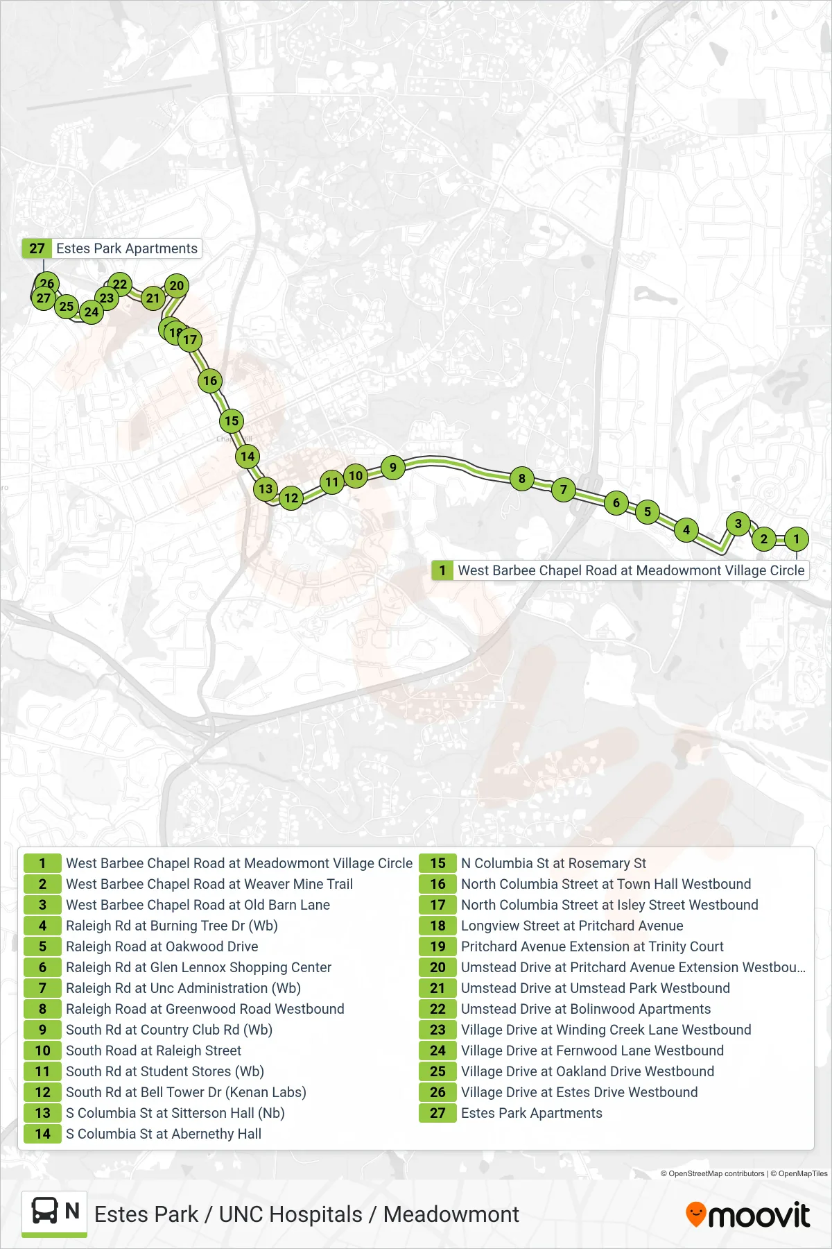
Stops list (N - West Barbee Chapel Road at Meadowmont Village Circle→Estes Park Apartments)
- West Barbee Chapel Road at Meadowmont Village Circle
- West Barbee Chapel Road at Weaver Mine Trail
- West Barbee Chapel Road at Old Barn Lane
- Raleigh Rd at Burning Tree Dr (Wb)
- Raleigh Road at Oakwood Drive
- Raleigh Rd at Glen Lennox Shopping Center
- Raleigh Rd at Unc Administration (Wb)
- Raleigh Road at Greenwood Road Westbound
- South Rd at Country Club Rd (Wb)
- South Road at Raleigh Street
- South Rd at Student Stores (Wb)
- South Rd at Bell Tower Dr (Kenan Labs)
- S Columbia St at Sitterson Hall (Nb)
- S Columbia St at Abernethy Hall
- N Columbia St at Rosemary St
- North Columbia Street at Town Hall Westbound
- North Columbia Street at Isley Street Westbound
- Longview Street at Pritchard Avenue
- Pritchard Avenue Extension at Trinity Court
- Umstead Drive at Pritchard Avenue Extension Westbound
- Umstead Drive at Umstead Park Westbound
- Umstead Drive at Bolinwood Apartments
- Village Drive at Winding Creek Lane Westbound
- Village Drive at Fernwood Lane Westbound
- Village Drive at Oakland Drive Westbound
- Village Drive at Estes Drive Westbound
- Estes Park Apartments