
Recorrido de la línea N autobús
Consulta el mapa de la ruta de N y mira todas las paradas de N a lo largo del recorrido. El mapa de N muestra por dónde transita el autobús y la ubicación de cada parada, lo que facilita entender toda la ruta de un vistazo.
Explora las rutas de Chapel Hill Transit en el mapa y consulta por dónde operan los servicios de autobús de Chapel Hill Transit. Usa el mapa de N para encontrar las paradas de autobús y ver cómo la N conecta distintas zonas a lo largo de su recorrido.
Todas las paradas de N en el mapa se muestran en el orden de la ruta, lo que te ayuda a seguir el autobús de N desde la primera parada hasta la última.
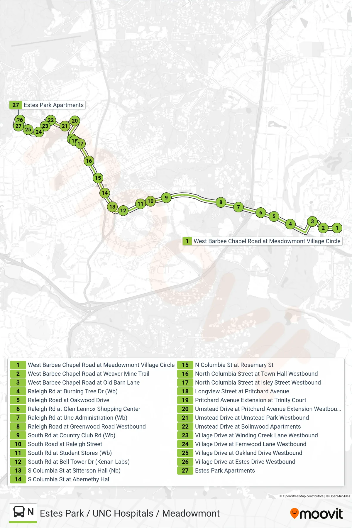
Lista de paradas (N - West Barbee Chapel Road at Meadowmont Village Circle→Estes Park Apartments)
- West Barbee Chapel Road at Meadowmont Village Circle
- West Barbee Chapel Road at Weaver Mine Trail
- West Barbee Chapel Road at Old Barn Lane
- Raleigh Rd at Burning Tree Dr (Wb)
- Raleigh Road at Oakwood Drive
- Raleigh Rd at Glen Lennox Shopping Center
- Raleigh Rd at Unc Administration (Wb)
- Raleigh Road at Greenwood Road Westbound
- South Rd at Country Club Rd (Wb)
- South Road at Raleigh Street
- South Rd at Student Stores (Wb)
- South Rd at Bell Tower Dr (Kenan Labs)
- S Columbia St at Sitterson Hall (Nb)
- S Columbia St at Abernethy Hall
- N Columbia St at Rosemary St
- North Columbia Street at Town Hall Westbound
- North Columbia Street at Isley Street Westbound
- Longview Street at Pritchard Avenue
- Pritchard Avenue Extension at Trinity Court
- Umstead Drive at Pritchard Avenue Extension Westbound
- Umstead Drive at Umstead Park Westbound
- Umstead Drive at Bolinwood Apartments
- Village Drive at Winding Creek Lane Westbound
- Village Drive at Fernwood Lane Westbound
- Village Drive at Oakland Drive Westbound
- Village Drive at Estes Drive Westbound
- Estes Park Apartments